
Below the central Beacons
Libanus
An A470 village beneath Mynydd Illtud, with a country inn, a National Park visitor centre and routes across the common and up Pen y Fan.
- Village base
- On the A470, about four miles south of Brecon
- Above Libanus
- The Mountain Centre on Mynydd Illtud
- After dark
- An official Dark Sky Discovery Site
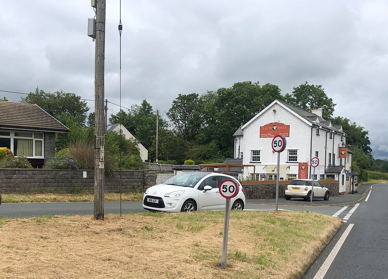
Photo: Eirian Evans · CC BY-SA 2.0 · cropped
The Fox verdict
A small village with a broad upland horizon
Libanus joins an A470 country inn to the walks, views and visitor facilities of Mynydd Illtud above the village.
Come for the Mountain Centre's outlook across the National Park, the three-hour circuit of Mynydd Illtud Common or the four-mile Pen y Fan route from the Storey Arms area. The visitor-centre café and the Tai'r Bull Inn give the day two well-evidenced food stops.
Where to go
Places in Libanus
Every place below is checked against a published source, listed with what it is and how long to give it.
Local signatures
3 placesVisitor-centre café
The café serves all-day breakfasts, lunches, tea, coffee and homemade cakes, uses local suppliers and provides a dog-friendly area.
- Visit length
- Editorial estimate: allow around 60 minutes
- Locality
- at the National Park Visitor Centre
- Access
- A dog-friendly area is provided.
Terrain Rider
The Terrain Rider is an all-terrain mobility scooter available for bookable sessions on Mynydd Illtud Common, with a briefing and route map.
- Visit length
- Editorial estimate: Allow two hours
- Locality
- at the National Park Visitor Centre on Mynydd Illtud
- Access
- Advance booking, a briefing and a route map are required; the all-terrain mobility scooter is free to book.
Mountain Centre Dark Sky Discovery Site
An official Dark Sky Discovery Site with open sky in every direction and hard-surfaced areas for wheelchair users.
- Visit length
- Editorial estimate: allow around 60 minutes
- Locality
- at the Mountain Centre
- Access
- The site has unrestricted access and hard or tarmac areas for wheelchair users.
Food & drink
1 place
The Tai'r Bull Inn
A family-run country pub, British and Welsh restaurant and en-suite inn, with a log fire in winter and a resident real ale alongside changing guest ales.
- Visit length
- Editorial estimate: allow around 90 minutes
- Locality
- on the A470 in Libanus
- Access
- Dogs are welcome, and the inn publishes a Doggy Sunday Dinner menu.
Walks & outdoors
3 placesMynydd Illtud Common Walk
This official common circuit climbs to the Iron Age hillfort of Twyn y Gaer, with views to Pen y Fan, Corn Du, the Black Mountains and the River Usk and chances to see upland birds.
- Visit length
- Editorial estimate: Allow about three hours
- Locality
- starting at the National Park Visitor Centre
- Access
- The grade 3 route has occasional long gradients, poor surfaces and kissing gates or stiles, with no seats.
Mynydd Illtud Geotrail and Traeth Mawr
Routes cross Devonian Old Red Sandstone and pass Traeth Mawr, where peat preserves a record of South Wales climate since the Ice Age.
- Visit length
- Editorial estimate: allow around 90 minutes
- Locality
- on Mynydd Illtud Common and at Traeth Mawr
- Access
- The terrain is largely level and barrier-free but uneven, and the common is sheep-grazed.
Pen y Fan from Storey Arms
A moderate four-mile circuit from the Storey Arms area reaches Pen y Fan, the highest summit in the National Park, with views down the Neuadd Valley before the final ascent.
- Visit length
- Editorial estimate: allow around three hours
- Locality
- from the Storey Arms area south of Libanus
Things to do
1 placeBannau Brycheiniog National Park Visitor Centre
Known locally as the Mountain Centre, it has visitor information, maps, interactive exhibits, a children's play area, wildlife garden, field for informal games, toilets and picnic space.
- Visit length
- Editorial estimate: allow around 60 minutes
- Locality
- above Libanus on Mynydd Illtud
- Access
- There is no direct public transport to the Mountain Centre; the authority describes the walk from the village as about 20 minutes.
No places match this filter. Choose All places to reset the list.
Three ways to explore Libanus
Signature outings
Welsh and British cooking at the Tai'r Bull
The family-run inn pairs its winter log fire with Welsh and British cooking, a resident real ale and changing guest ales.
The Mountain Centre outlook
From the visitor centre, the central Beacons and Pen y Fan form the southern backdrop while the common looks north over the Usk Valley.
Pen y Fan from Storey Arms
Follow the moderate four-mile circuit from the Storey Arms area to Pen y Fan, with Neuadd Valley views before the final ascent.
The village story
Libanus Village Guide
An A470 village whose inn, chapel story and Mountain Centre open onto Mynydd Illtud, Pen y Fan and the Usk Valley.
The inn and the Mountain Centre
The Tai'r Bull Inn stands on the A470 where the road runs through Libanus, and in winter a log fire does most of the talking. Katie runs it with her team, and the kitchen leans on Welsh and British cooking that recent visitors tend to describe in specifics: beef rolls with roast potatoes and dripping gravy, a lamb Sunday roast with Yorkshire pudding, apple-and-plum crumble with custard. Other plates come and go — a spicy chicken sizzler, hake with sweet chilli and honey baked in a Mediterranean gratin, mint-and-chocolate cheesecake. Dogs are welcome, and there is a Doggy Sunday Dinner for them; one regular, a dog called Rhubarb, has been named in passing by the landlady. A resident real ale sits alongside changing guests.
The village has no shop for food. Up on Mynydd Illtud, about twenty minutes' walk above the houses or via a signed minor road, the National Park Visitor Centre — the Mountain Centre, as it is known locally — has a gift and craft shop instead.
Food, craft and wide horizons
The café there serves all-day breakfasts, lunches and homemade cakes, with a corner for dogs and local suppliers behind the kitchen. Next to it, Platform One Craft Co-operative sells the work of twelve makers based in and around the National Park, with one of them on hand each day. There is a children's play area, a wildlife garden, a field for informal games, toilets and picnic space. A free all-terrain mobility scooter, the Terrain Rider, can be booked for two-hour sessions on the common with a briefing and a route map.
The view is the reason to come up. The National Park Authority calls it "one of the best views of Pen-y-fan and right across the National Park," and from the common the central Beacons and Pen y Fan fill the southern horizon while the land falls away north over the Usk Valley. After dark the same ground is an official Dark Sky Discovery Site, with hard-surfaced areas for wheelchairs and an open sky in every direction.
Common walks and chapel origins
A five-kilometre circuit of Mynydd Illtud Common, grade 3 and about three hours, starts at the centre. It climbs to Twyn y Gaer, an Iron Age hillfort with pillow mounds on its slopes and long views to Corn Du, the Black Mountains and the River Usk; red kites, larks, wheatears and stonechats work the open ground. Lower down, the routes cross toward Traeth Mawr, a wetland whose peat has kept a record of the local climate since the Ice Age. For the bigger objective, the Storey Arms area a little south on the A470 is a start for Pen y Fan, a moderate four-mile circuit to the highest summit in the park. The Storey Arms itself was a coaching inn, demolished in 1924; the name outlived the building.
Libanus grew in the 1820s, when two hamlets, Tai'r Bull and Pont Clyn, drew together around a new Independent chapel and took its name — Libanus being the Latin for Lebanon, a common choice for Welsh chapels. The chapel's early years were not smooth: an allegedly dishonest treasurer let an £80 debt climb to £120, an unsuccessful first minister made matters worse, and county ministers had to step in. The original chapel was demolished in 1969 for the widening of the A470; its replacement opened across the road in 1972.
Connections and a final craft encounter
Libanus is directly on the A470, about four miles south of Brecon, which handles town shopping and has a cathedral that began as a Benedictine priory church. The TrawsCymru T4 stops in the village on its run between Brecon and Merthyr Tydfil, the nearest railhead, roughly twelve miles away in a straight line.
Back at the centre, whichever of the twelve makers has come in that day is somewhere among the crafts, ready to tell you about the one you have just picked up.
Stay around Brecon Beacons
Make a longer stay of it
Travel Fox holiday homes around Brecon Beacons, linked directly to their property pages.
For homeowners
Own a holiday home near Libanus?
We manage holiday lets across the UK from 12% commission, charged after cleaning costs, with no lock-in. A co-founder visits before you decide.
How our holiday let management works →
A guide with a point of view
Written from research. Edited for real journeys.
Use the Official site links for live practical details, then use this guide for context, ideas and room to explore.
Photography credits & licences
Third-party photographs are credited to their named creators and reused under the linked Creative Commons licence or public-domain dedication. Travel Fox stores an optimised local copy; the file-specific changes and any browser-applied display crop are disclosed below. Reused photographs link both to the Wikimedia Commons source record and to the declared source image; Travel Fox's own photographs carry no such record and are marked as ours. These image licences do not cover Travel Fox text, branding or page design.
- File:Tai'r Bull Inn, Libanus - geograph.org.uk - 7059741.jpg — photograph by Eirian Evans; Tai'r Bull Inn, Libanus by Eirian Evans. Source record on Wikimedia Commons. Declared source image. Licence: CC BY-SA 2.0. File changes: Downloaded from Wikimedia Commons, resized to a maximum 1920px edge and encoded as an optimised JPEG. Display changes: Displayed with responsive CSS cropping.
Sources
Every place on this page is checked against a published source. Each entry links the record we used and names who publishes it.
- The Tai'r Bull Inn — thetairbullinn.co.uk operator, sector body or destination organisation
- Bannau Brycheiniog National Park Visitor Centre — bannaubrycheiniog.org operator, sector body or destination organisation
- Visitor-centre café — beacons-npa.gov.uk statutory register or public authority
- Terrain Rider — beacons-npa.gov.uk statutory register or public authority
- Mynydd Illtud Common Walk — fforestfawrgeopark.org.uk other published source
- Mynydd Illtud Geotrail and Traeth Mawr — fforestfawrgeopark.org.uk other published source
- Mountain Centre Dark Sky Discovery Site — darkskydiscovery.org.uk operator, sector body or destination organisation
- Pen y Fan from Storey Arms — visitwales.com operator, sector body or destination organisation