
Eden Valley market town
Penrith
Red sandstone, deep border history and a climb to a beacon above the Eden Valley.
- Best for
- Local food and layered border history
- Give it
- A day split between town and Beacon Hill
- Don't miss
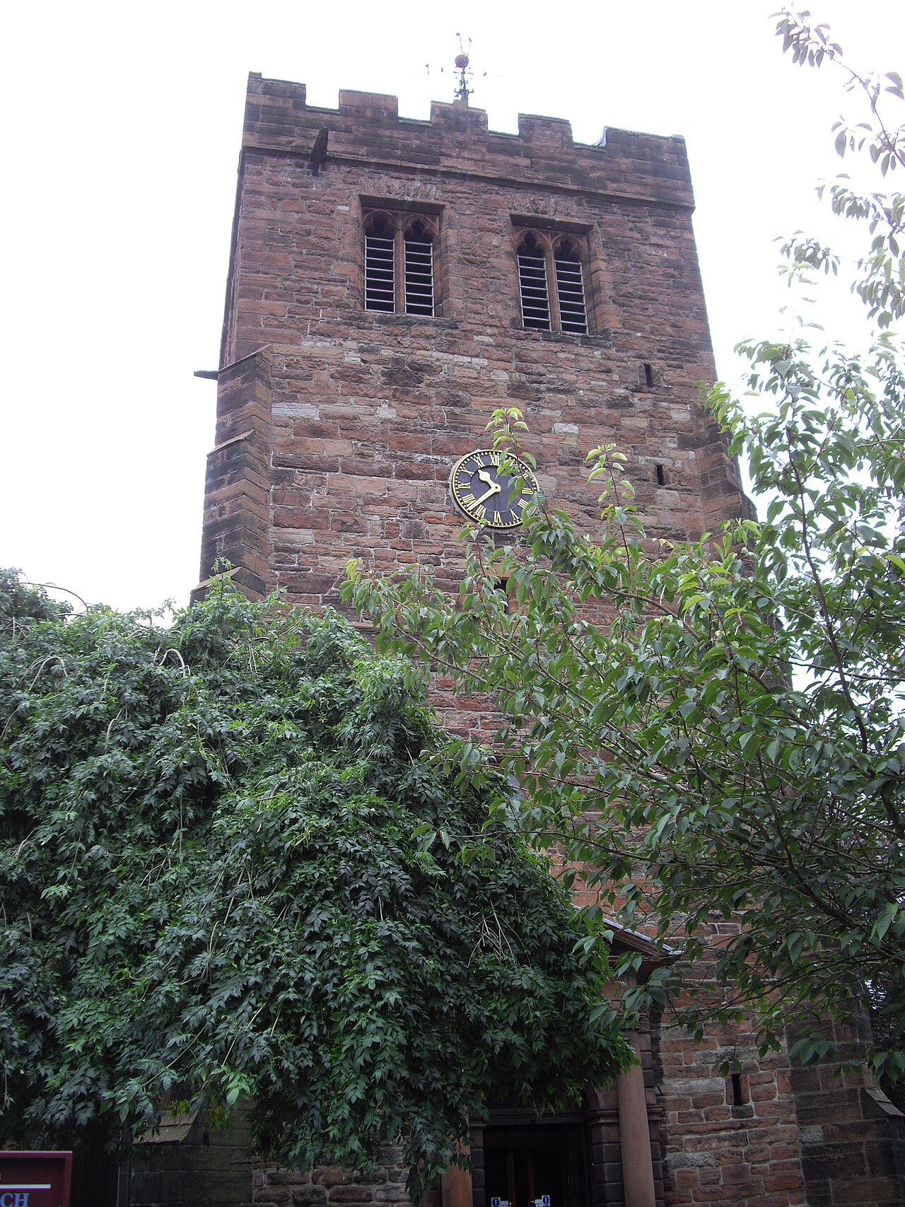
- St Andrew's Giant's Grave
Photo: PAUL FARMER · CC BY-SA 2.0 · cropped
The Fox verdict
A red-sandstone town with a long border memory
Penrith combines local food, medieval remains and a wooded climb to a beacon overlooking the Eden Valley.
Start with the castle and St Andrew's, make room for a Cranstons counter, then follow Fell Lane towards Beacon Pike. Nearby choices extend the day to Rheged and Lowther's open-air ruin and gardens.
Your picks, your pace
Make Penrith Town Guide | Travel Fox yours
Choose a mood or build your own list. Your saved stops are an ordering aid, with a direct map route when you are ready.
Local signatures
3 placesCranstons Cumbrian Food Hall
A butchery, deli, fish counter, hot food counter and first-floor cafe stocking produce from more than 100 Cumbrian producers.
- Visit length
- Editorial estimate: around 60 minutes
- Locality
- Penrith
Rheged Centre
A gallery, cafe, cinema and shops with an indoor play and making space for children.
- Visit length
- Editorial estimate: around 120 minutes
- Locality
- just outside town
Lowther Castle & Gardens
A vast Regency ruin open to the sky, with gardens within gardens and one of the UK's largest adventure playgrounds.
- Visit length
- Editorial estimate: around 120 minutes
- Locality
- about five miles south of Penrith
Food & drink
1 placeDockray Hall
A historic pub and restaurant in a building dating to the 14th century, known for cask ales, gins and home cooking.
- Visit length
- Editorial estimate: around 90 minutes
- Locality
- Penrith
Walks & outdoors
1 placePenrith Beacon
A wooded climb to the 286-metre summit of Beacon Hill, crowned by a red-sandstone beacon tower and opening to views across the Eden Valley, Pennines and Lakeland fells.
- Visit length
- Editorial estimate: around 120 minutes
- Locality
- Beacon Hill
History & heritage
2 places
St Andrew's Church
A Grade I church with a medieval defensive tower, a Georgian body rebuilt in 1720, the Norse Giant's Grave in its churchyard and paintings by Penrith-born Jacob Thompson inside.
- Visit length
- Editorial estimate: around 45 minutes
- Locality
- Penrith
Penrith Castle
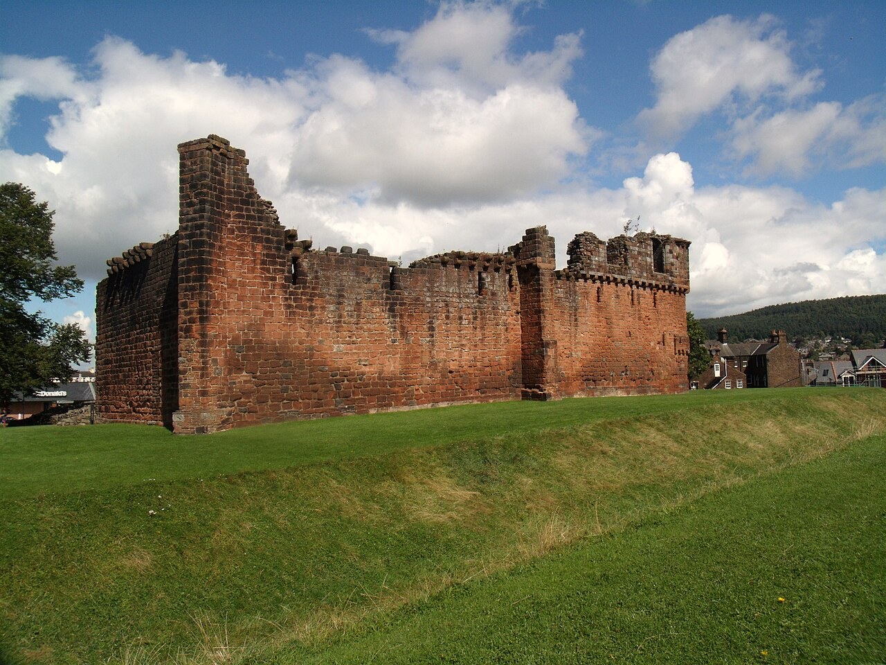
Red-sandstone castle ruins built between 1399 and 1470 to defend against Scottish raids, later associated with Richard, Duke of Gloucester.
- Visit length
- Editorial estimate: around 60 minutes
- Locality
- Penrith
Things to do
1 placePenrith Castle Park
The town's largest grassed area, with a children's play area, putting and crazy golf, tennis courts, bowling green, bandstand, gardens and a cafe.
- Visit length
- Editorial estimate: around 60 minutes
- Locality
- Penrith
No places match this filter. Choose All places to reset the list.
On the map
Penrith at a glance
Tap a marker to jump to its guide card.
Three ways to explore Penrith
Signature outings
Meet the Giant's Grave
See the pair of 10th-century Norse cross shafts and four hogback stones in St Andrew's churchyard.
Reach the red beacon
Follow Fell Lane and a wooded path to the 1719 beacon tower on Beacon Hill.
Walk Richard's castle ruins
Explore the remains of the castle where Richard, Duke of Gloucester, lived for periods between 1471 and 1485.
The town story
Penrith Town Guide
Local food, red sandstone and border history at the north-eastern edge of the Lake District.
Local Food and Red Sandstone
Cranstons has been selling meat on King Street since 1914, and it shows no sign of stopping. The original shop still runs traditional meat and deli counters and sends out hot meat rolls daily. Two minutes from the M6 there's the larger Cumbrian Food Hall — butchery, deli, a fish counter run by Fyne Fish, a hot food counter, and Oswald's café on the first floor, stocking produce from more than a hundred Cumbrian producers. Cumberland sausages and dry-cured bacon are the things to leave with. It took Best Specialist Food Retailer at the 2024 Cumbrian Food Awards.
The town is built of red St Bees sandstone, which gives the whole place a warm colour on a grey day, and grey days are not in short supply here. Penrith sits at the north-eastern edge of the Lake District, in the Eden Valley, roughly six miles from Ullswater and seventeen south of Carlisle. It calls itself the gateway to the Lakes, which is fair enough.
Pubs and a Jacobite Footnote
For a pub, Dockray Hall is the one with the deepest history — a 14th-century building said to have housed Richard, Duke of Gloucester before he became Richard III. These days it's known for cask ales, gins and home cooking. The General Wolfe, in the town centre, is a real-ale house with locally brewed beer. Just south-west at Yanwath, the 17th-century Yanwath Gate Inn cooks with local produce and welcomes dogs in the bar.
The George Hotel on Devonshire Street has its own footnote: Bonnie Prince Charlie stayed here on 21 November 1745 as the Jacobite army marched south. The locals were not sympathetic, and took to harassing the retreating Scots with what the records call Sunday hunting.
Church Stones and Beacon Views
St Andrew's is the church to see. The medieval tower is thick-walled and defensive — a pele tower in all but name — while the body was rebuilt in 1720 on the model of St Andrew's, Holborn. Pevsner called it "the stateliest church of its time in the county." In the churchyard stands the Giant's Grave, a pair of 10th-century Norse cross shafts flanked by four hogback stones, said to mark boars killed by a king in Inglewood Forest. Inside hang two paintings by the Penrith-born artist Jacob Thompson and a pair of brass chandeliers given in 1745 by the 2nd Duke of Portland.
From the town centre, Fell Lane and a wooded path climb to Beacon Pike, 286 metres up, crowned by a red sandstone beacon tower built in 1719. On a clear day you can see the Pennines, the Lakeland fells, and the Scottish mountains across the Solway Firth. A 3.8-mile loop links the beacon with the castle ruins.
Rails, Lake and Border Country
The station is a mile from the centre, directly opposite the castle, on the West Coast Main Line between Euston and Glasgow. The 508 bus runs out to Ullswater, where the Steamers have been cruising the lake since the 1850s.
Penrith does not appear in the Domesday Book. In 1086 the surveyors left it alone, because the area was still reckoned to be part of Scotland, and for centuries afterwards the town sat squarely on the line between the two.
Stay around Cumbria
Make a longer stay of it
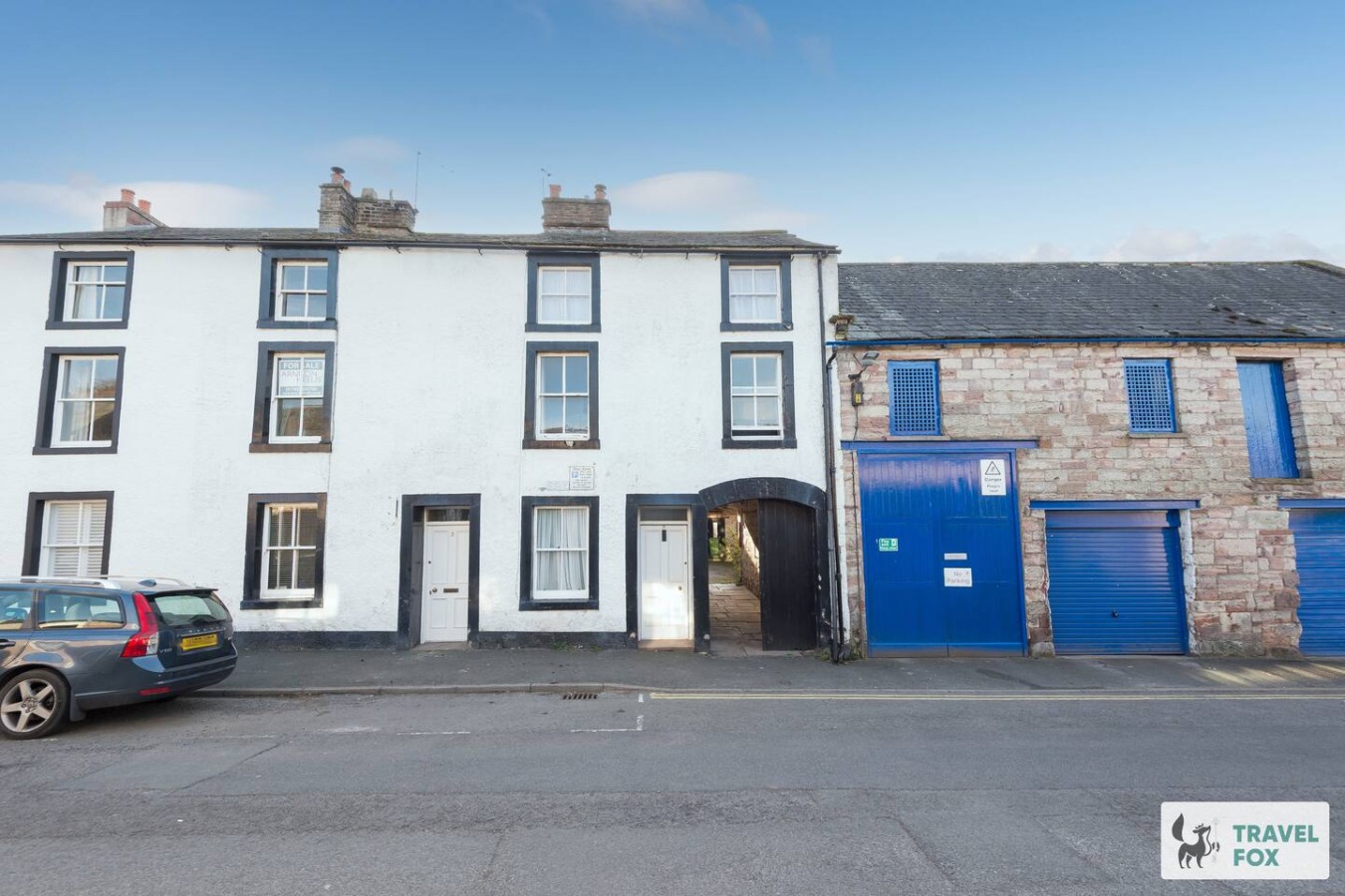
Travel Fox holiday homes around Cumbria, linked directly to their property pages.
A guide with a point of view
Written from research. Edited for real journeys.
Use the Official site links for live practical details, then use this guide for context, ideas and room to explore.
Photography credits & licences
Third-party photographs are credited to their named creators and reused under the linked Creative Commons licence or public-domain dedication. Travel Fox stores an optimised local copy; the file-specific changes and any browser-applied display crop are disclosed below. Reused photographs link both to the Wikimedia Commons source record and to the declared source image; Travel Fox's own photographs carry no such record and are marked as ours. These image licences do not cover Travel Fox text, branding or page design.
- File:The tower of St Andrew's Church Penrith - geograph.org.uk - 1561838.jpg — photograph by PAUL FARMER; PAUL FARMER. Source record on Wikimedia Commons. Declared source image. Licence: CC BY-SA 2.0. File changes: Downloaded from Wikimedia Commons, resized to a maximum 1920px edge and encoded as an optimised JPEG. Display changes: Displayed with responsive CSS cropping.
- File:Penrith Castle - geograph.org.uk - 2574500.jpg — photograph by Euan Nelson; Penrith Castle by Euan Nelson. Source record on Wikimedia Commons. Declared source image. Licence: CC BY-SA 2.0. File changes: Downloaded from Wikimedia Commons, resized to a maximum 1920px edge and encoded as an optimised JPEG. Display changes: Displayed with responsive CSS cropping.
Sources
Every place on this page is checked against a published source. Each entry links the record we used and names who publishes it.
- St Andrew's Church — parishofpenrith.org.uk other published source
- Penrith Castle — english-heritage.org.uk national body or asset manager
- Penrith Beacon — historicengland.org.uk statutory register or public authority record not machine-readable; publisher restricts automated access
- Penrith Castle Park — westmorlandandfurness.gov.uk statutory register or public authority
- Cranstons Cumbrian Food Hall — cranstons.net operator, sector body or destination organisation
- Dockray Hall — dockrayhall.com operator, sector body or destination organisation
- Rheged Centre — rheged.com operator, sector body or destination organisation
- Lowther Castle & Gardens — lowthercastle.org operator, sector body or destination organisation