
The Queen of the Cotswolds
Painswick
A steep-sided hill town of silvery limestone, famed for its historic wool wealth, dramatic vistas, and one of England's grandest churchyards.
- Best for
- Walking and historic gardens
- Give it
- A full weekend
- Don't miss
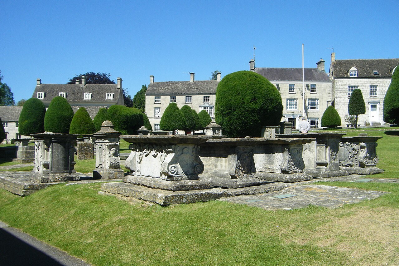
- The 'caddy' tombs of St Mary's
Photo: Hugh Llewelyn · CC BY-SA 2.0 · cropped
The Fox verdict
A refined Cotswold retreat
Painswick trades the honey-gold stone of the east for a pale, silvery limestone and a verticality that makes every stroll an exercise.
Unlike the flatter valley villages, Painswick is a compact hill town where the architecture of the wool trade clings to steep slopes. It is a place of quiet theatricality, whether in the meticulously clipped yews of its Grade I churchyard or the serpentine paths of its Rococo garden. While the town centre is small, the surrounding landscape—from the Iron Age ramparts of the Beacon to the mill-lined stream—offers a depth of exploration that rewards those who enjoy a steep climb.
Your picks, your pace
Make Painswick yours
Choose a mood or build your own list. Your saved stops are an ordering aid, with a direct map route when you are ready.
Local signatures
3 places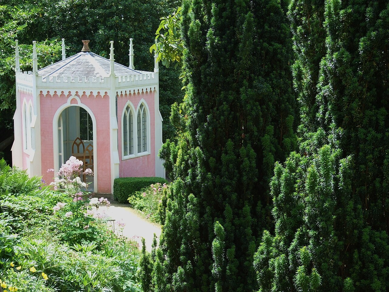 Start here
Painswick Rococo Garden
The only complete Rococo garden left in the country, featuring a theatrical landscape of serpentine paths, a maze, and follies such as Eagle House and the Gothic Alcove.
- Visit length
- Editorial estimate: around 180 minutes
- Locality
- Short walk from centre
- Access
- Visiting days vary through the year.
The Oak
A 16th-century listed pub with an irregular interior and real fires, formed by the 1891 merger of the Royal Oak and the Red Lion.
- Visit length
- Editorial estimate: around 90 minutes
- Locality
- Village centre
Arts Café
A community café pairing locally sourced food—including paninis named after local landmarks—with a shop selling original local art and crafts.
- Visit length
- Editorial estimate: around 60 minutes
- Locality
- Painswick Centre
Food & drink
1 placeThe Falcon
A Georgian townhouse inn established in Painswick in 1828, with bedrooms, a bar and a family-run restaurant focused on locally sourced, seasonal food.
- Visit length
- Editorial estimate: around 90 minutes
- Locality
- Village centre
Walks & outdoors
1 place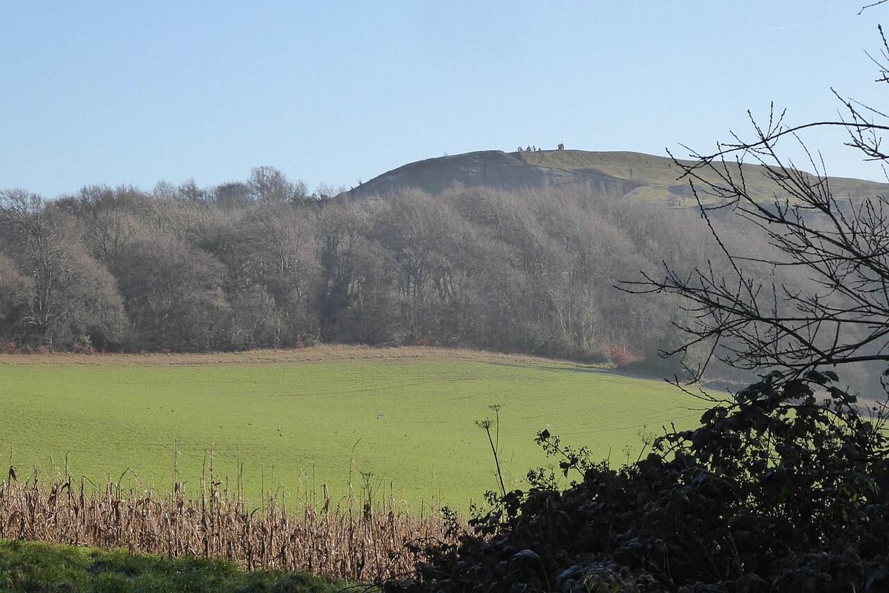
Painswick Beacon
An Iron Age hillfort with multiple ramparts offering views of the Severn Vale, Gloucester and the Malvern Hills. Paths across limestone grassland skirt the neighbouring golf course.
- Visit length
- Editorial estimate: around 120 minutes
- Locality
- Above the town
History & heritage
3 places
St Mary's Church
A Grade I listed church featuring a 15th-century Purbeck-marble tomb and a Snetzler organ. The churchyard is renowned for its 'caddies'—carved limestone table tombs—and its famous collection of clipped yews.
- Visit length
- Editorial estimate: around 90 minutes
- Locality
- Village centre
Kate Rich
An antique and decorative pieces shop selling textiles, porcelain, and small furniture from a repurposed historic inn.
- Visit length
- Editorial estimate: around 60 minutes
- Locality
- Village centre
Tourist Information Office
A volunteer-run office providing maps, guidebooks, and local histories, serving as an ideal starting point for walkers.
- Visit length
- Editorial estimate: around 30 minutes
- Locality
- St Mary's churchyard
No places match this filter. Choose All places to reset the list.
On the map
Painswick at a glance
Tap a marker to jump to its guide card.
Three ways to explore Painswick
Signature outings
The Grandest Churchyard
Wander among the exceptional 18th-century carved limestone table tombs at St Mary's.
Panoramic Vistas
Climb to the Iron Age hillfort at Painswick Beacon for views stretching across the Severn Vale to Wales.
Rococo Romance
Follow the serpentine paths and discover the theatrical follies of the restored Rococo Garden.
The town story
Painswick Town Guide
A journey through the silvery stone and steep slopes of the Cotswolds' most dramatic hill town.
Historic Inns and Fine Dining
The Falcon stands opposite the church in a Georgian townhouse with a history dating to 1828. Its eleven bedrooms, bar and dining rooms make it a central base for a stay in Painswick. The family-run kitchen focuses on locally sourced, seasonal food, and dogs are welcome in the rooms and public areas.
A short step away, the Oak occupies a listed sixteenth-century building with a small, irregular interior, a real fire and separate drinking areas. In 1891 the Royal Oak absorbed the neighbouring Red Lion, leaving two old buildings joined behind the unusual frontage. A partly sheltered rear courtyard adds space for families and dogs. Its two changing cask ales have included Hop Union Maiden Voyage and Stroud Brewery's OPA, with local beer favoured where possible.
Above the old centre, Painswick Golf Club Bar & Cafe welcomes golfers, other guests and dogs. The clubhouse serves breakfast, light lunch, hot drinks and cakes, and its sun terrace looks across the eighteenth hole towards the Slad Valley. The hilltop setting and wide views give the stop its appeal.
Community Hubs and Local Trade
The Best of The Painswick menu lists slow-baked beetroot tart with burnt apple and ajo blanco; mushroom on toast with roasted garlic, hazelnut and Wiltshire truffle; roast stone bass with blackened aubergine and confit winter tomato; and Cornbury Park Estate venison with sand carrot and kale. Desserts include mango sorbet with lightly spiced pineapple, coconut and yoghurt; apple tart tartin with crème fraîche; and Calcot honey parfait with Yorkshire rhubarb and dark chocolate.
Everyday eating and browsing meet at the Arts Café, where Lauren and Jayne pair a café with a shop of locally made art and craft. Its paninis take their names from local landmarks: the 99 Yews comes with cheddar, red-onion chutney, ham and tomato; the Beacon has cheddar and chutney; Juniper Wood has mozzarella, pesto and tomato; and the Lychgate has Brie and cranberry. There is also a Rococo Gardens bagel with smoked salmon and cream cheese. Jayne makes the quiches, the menu includes St Michael's soup, and the coffee is locally and ethically sourced. Dogs are welcome inside and out. The shop sells original paintings and prints, textiles, cushions, local honey, beeswax candles, ceramics and chocolate.
Thursday mornings bring the Painswick Centre's market, with food made mostly within five miles. Traders rotate; suppliers include SALT Bakehouse with sourdough, loaves and pastries, A Wild Garden with condiments, Padstow Fish, and Peter Jackson with jams and preserves. Thursday evening takeaways rotate among Burgerlish's organic grass-fed beef in Hobbs House buns, BBQ Society's smoked meats, Bros & Doughs' pizza, Minyakis' Japanese food and Taste of Punjab's Punjabi dishes. Painswick Stores on St Marys Street supplies fresh bread, fruit and vegetables, meat, frozen food, newspapers and food to go. The independent Painswick Pharmacy handles prescriptions and sells toiletries, Rimmel cosmetics and Fair Trade groceries.
The Architecture of the Hill Town
The other shops reward a slow wander. Kate Rich sells antiques and decorative pieces — textiles, porcelain, small furniture, garden ornaments — from part of what used to be the Golden Heart pub, one of several old inns that closed and found a second life. Painswick Fabrics deals in discount designer fabric. The Tourist Information office occupies the old grave-digger's hut in the churchyard and sells maps, guidebooks and local histories, which makes it a sensible first stop if you have arrived to walk.
You will notice the stone before you notice anything else. Painswick is a compact hill town of steep, narrow streets built from a pale, silvery local limestone rather than the honey colour associated with the eastern Cotswolds. The fine houses are what wool money left behind, and they sit close together on slopes that make every walk to the shop a small piece of exercise.
At the centre of it all is St Mary's, a Grade I church of local Painswick stone whose tall spire has twice been struck by lightning, in 1763 and 1883. Inside are a fifteenth-century Purbeck-marble tomb under a Tudor canopy, a stone reredos carved by John Bryan in 1743, and a Snetzler organ of 1770. The church keeps fourteen bells and about three hundred embroidered kneelers, designed by the sacristan Anne Yeo and worked over four years by some sixty people, showing local buildings, societies and animals. Outside, the churchyard is the reason many people come. Its late-seventeenth- and eighteenth-century carved limestone table tombs, known locally as "caddies", are the work of masons including the Bryan family, whose own pyramid-shaped tomb stands among them, and are reckoned the finest such collection in the Cotswolds. The broadcaster Alec Clifton-Taylor called this "the grandest churchyard in England". The clipped yews are the churchyard's signature, and tradition holds that ninety-nine of them grow here and that the Devil will not allow a hundredth. A ceremonial hundredth was planted in 2000 and has survived, so the number is now part of the name rather than a headcount, and the dark, clipped avenues of yew run right up to the church walls.
Walks, the Beacon and Painswick's Past
The walking is a large part of why you would stay. The Cotswold Way, 102 miles between Chipping Campden and Bath, passes through the town at roughly its midpoint; the stretch down from Birdlip is 8.6 miles over Cooper's Hill and the Beacon's ramparts, and the onward stretch to King's Stanley is 7.8 miles by Wash Brook and Haresfield Beacon. Closer to home, a three-mile circuit follows the Painswick Stream past the sites of five old mills before a steep climb back to town. A longer four-mile route adds Frith Wood and Juniper Hill and can be extended to Slad, the Woolpack and the church associated with Laurie Lee's Cider with Rosie. Up on the Beacon, a two-mile stile-free route crosses limestone grassland and the Iron Age hillfort, with the Severn Vale, Gloucester, the Malvern Hills and, on a clear day, Wales laid out to the west.
That hillfort is the oldest layer of a long story. Painswick Hill encloses nearly nine hectares within multiple ramparts and was probably used as a Royalist outpost during the 1643 siege of Gloucester. By Domesday the manor was large for its area: sixty-seven recorded households, four mills and an annual value of twenty-four pounds and ten shillings, up from twenty pounds twenty years earlier, held under Roger of Lacy. Prosperity came later from wool and superfine broadcloth, which sustained the town from the mid-fifteenth century into the nineteenth. Nearly thirty cloth mills once lined the stream while cottage weavers worked higher up the slopes; Savory's Pin Mill, the last working mill, closed in 1982. Bisley Street keeps some of the oldest fabric in the town, including fourteenth-century buildings and "donkey doors" wide enough to bring a pack animal indoors.
The Civil War left its marks on the church itself. On 10 August 1643 Charles I issued a proclamation from his "Court at Payneswicke", ordering his soldiers, on pain of death, not to rob those bringing provisions to the royal camp before Gloucester. When fighting reached the town, Parliamentarians sheltered inside the church and Royalists attacked with cannon and firebombs; fire damage and soldiers' graffiti survive.
The Great Outdoors and Ancient Roots
A short walk from the centre, ten or fifteen minutes, is Painswick Rococo Garden, created by Benjamin Hyett in the 1740s and restored from near-jungle using a 1748 painting by Thomas Robins. Britain's only surviving Rococo garden is a theatrical landscape of serpentine paths and framed views, with follies including Eagle House, an octagonal Pigeon House and a Gothic Alcove. In late winter it grows more than five million snowdrops in fifteen or more varieties, among them Galanthus 'Atkinsii', named for the Painswick nurseryman James Atkins. A maze and children's play area add to its appeal for families.
Getting here is straightforward. Painswick sits on the A46, about three miles north of Stroud and ten south of Cheltenham, with the main car park just south of the church off Stamages. Stroud, three or four miles away, is the nearest railway station, and Stagecoach service 66 links Stroud, Painswick and Cheltenham by bus.
Thomas Twining, who founded the tea firm, was born here in 1675 and left for London as a boy of nine. The composer Gerald Finzi lived nearby, and the Painswick Music Society, founded in 1946, continues a spring concert tradition that paused during the Covid pandemic in 2020. The old Painswick Feast came with a "Puppy Dog Pie", which never contained dog. The village's Clypping takes place the first Sunday on or after 19 September, when the congregation forms a ring around the church, joins hands and sings. The old word means embracing.
Stay around Cotswolds
Make a longer stay of it
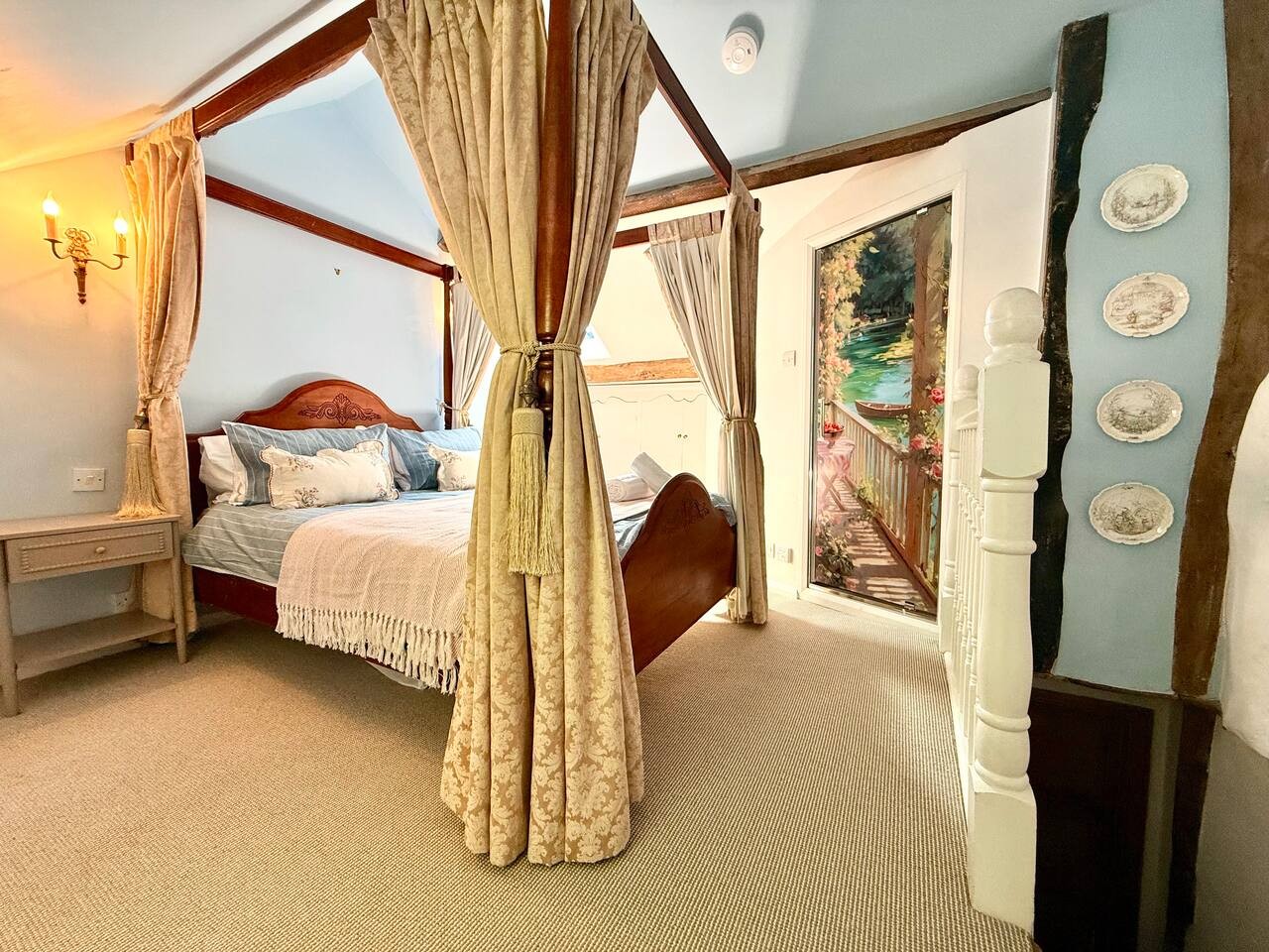
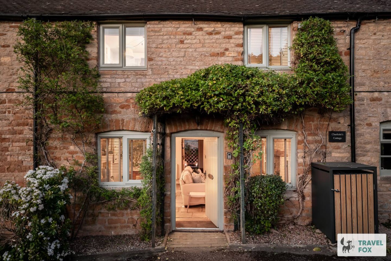
Travel Fox holiday homes around Cotswolds, linked directly to their property pages.
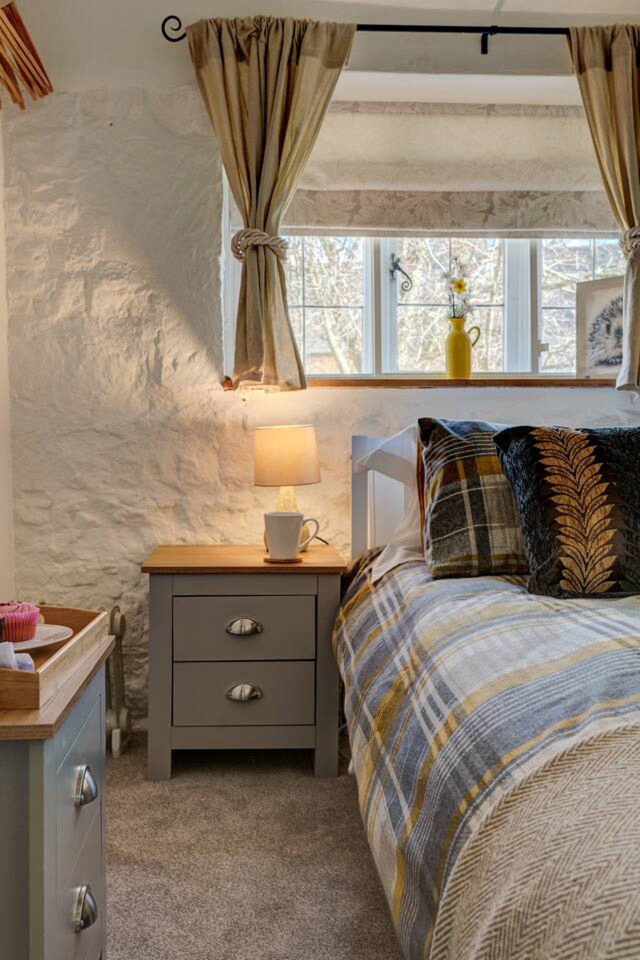
For homeowners
Own a holiday home near Painswick?
We manage holiday lets across the Cotswolds from 12% commission, charged after cleaning costs, with no lock-in. A co-founder visits before you decide.
Holiday let management in the Cotswolds →
A guide with a point of view
Written from research. Edited for real journeys.
Use the Official site links for live practical details, then use this guide for context, ideas and room to explore.
Photography credits & licences
Third-party photographs are credited to their named creators and reused under the linked Creative Commons licence or public-domain dedication. Travel Fox stores an optimised local copy; the file-specific changes and any browser-applied display crop are disclosed below. Reused photographs link both to the Wikimedia Commons source record and to the declared source image; Travel Fox's own photographs carry no such record and are marked as ours. These image licences do not cover Travel Fox text, branding or page design.
- File:Painswick Church (7817093500).jpg — photograph by Hugh Llewelyn; Painswick Church Uploaded by Oxyman. Source record on Wikimedia Commons. Declared source image. Licence: CC BY-SA 2.0. File changes: Downloaded from Wikimedia Commons, resized to a maximum 1920px edge and encoded as an optimised JPEG. Display changes: Displayed with responsive CSS cropping.
- File:View to Painswick Beacon - geograph.org.uk - 8231662.jpg — photograph by Philip Halling; View to Painswick Beacon by Philip Halling. Source record on Wikimedia Commons. Declared source image. Licence: CC BY-SA 2.0. File changes: Downloaded from Wikimedia Commons, resized to a maximum 1920px edge and encoded as an optimised JPEG. Display changes: Displayed with responsive CSS cropping.
- File:Rococo Gardens Painswick - geograph.org.uk - 1743672.jpg — photograph by Mark Holland; Mark Holland. Source record on Wikimedia Commons. Declared source image. Licence: CC BY-SA 2.0. File changes: Downloaded from Wikimedia Commons, resized to a maximum 1920px edge and encoded as an optimised JPEG. Display changes: Displayed with responsive CSS cropping.