
Moray Firth coast
Lossiemouth
Two contrasting beaches, a former fishing harbour and a town shaped by coastal walks, golf and seafaring history.
- Best for
- Beaches, harbour history and coastal walks
- Give it
- Several hours for the shore and harbour
- Don't miss
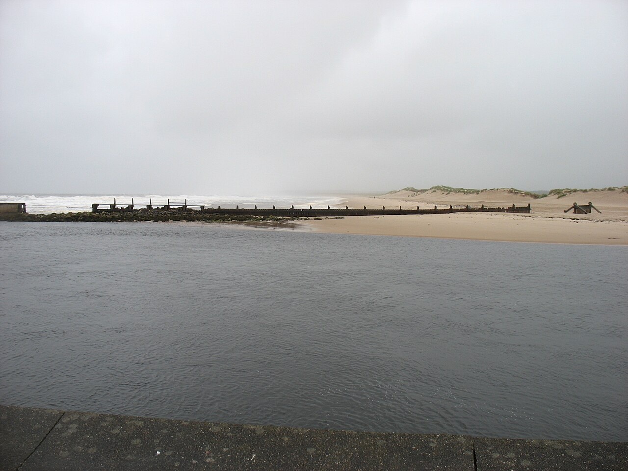
- The contrast between East Beach and West Beach
Photo: David Purchase · CC BY-SA 2.0 · cropped
The Fox verdict
A Moray coast town with two distinct shores
Lossiemouth combines long sands, harbour heritage and several ways to follow the coastline.
Choose East Beach for golden sand, dunes and year-round surfing, or West Beach for rockpools, cliffs, caves and the low-tide walk towards Covesea Lighthouse. The marina and fisheries museum keep the town's working-harbour story in view.
Where to go
Places in Lossiemouth
Every place below is checked against a published source, listed with what it is and how long to give it.
Local signatures
3 placesWest Beach
The wilder beach, with sand, rockpools, cliffs and caves on the way towards Covesea Lighthouse.
- Visit length
- Editorial estimate: Allow around 90 minutes
- Locality
- west from the town towards the lighthouse
- Access
- Best at low tide.
Moray Golf Club
Founded in 1889, with an Old Course laid out by Old Tom Morris and a New Course designed by Henry Cotton.
- Visit length
- Editorial estimate: Allow around 3 hours 30 minutes
- Locality
- Lossiemouth
Lossie Forest
Woodland for den-building and looking for red squirrels behind East Beach.
- Visit length
- Editorial estimate: Allow around 60 minutes
- Locality
- behind East Beach
Walks & outdoors
2 places
East Beach
Long golden sand backed by deliberately created dunes, with surfers using one of the few surf spots north of Aberdeen year-round.
- Visit length
- Editorial estimate: Allow around 90 minutes
- Locality
- over the River Lossie
- Access
- A footbridge from the Esplanade crosses the River Lossie to the beach.
Moray Coast Trail: Hopeman to Lossiemouth
A mainly flat coastal stretch of just over six miles, passing cliffs, coves and caves between Hopeman and Lossiemouth.
- Visit length
- Editorial estimate: Allow around 2 hours 30 minutes
- Locality
- Hopeman to Lossiemouth
- Access
- Surfaces include tarmac, gravel, earth, beach, rock and clifftop or forest tracks.
History & heritage
1 place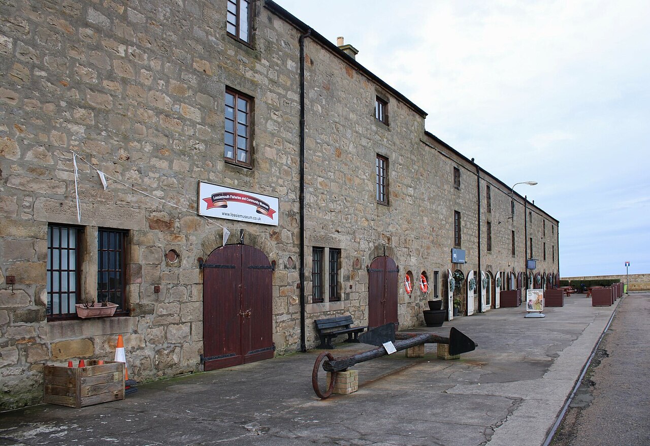
Lossiemouth Fisheries & Community Museum
A museum of the Scottish fishing industry past and present, with a reconstruction of Ramsay MacDonald's study and the original Covesea Lighthouse lens.
- Visit length
- Editorial estimate: Allow around 60 minutes
- Locality
- Pitgaveny Quay, in a former net-mending loft
Things to do
1 place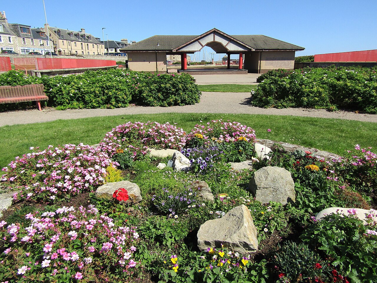
Station Park
A seafront park with a bandstand, playground and putting course on the site of the demolished railway station.
- Visit length
- Editorial estimate: Allow around 45 minutes
- Locality
- on the seafront
No places match this filter. Choose All places to reset the list.
Three ways to explore Lossiemouth
Signature outings
East Beach dunes
Use the footbridge over the River Lossie to reach long golden sand backed by dunes created in the early 1900s.
The net-mending loft
The fisheries museum at Pitgaveny Quay covers the Scottish fishing industry and preserves the original Covesea Lighthouse lens.
Station Park
The park's bandstand, playground and putting course occupy the site of Lossiemouth's demolished railway station.
The town story
Lossiemouth Town Guide
Marina life, contrasting beaches, a vanished railway and stories of Ramsay MacDonald and St Gerardine.
Harbour and Marina
Yachts now occupy the East Basin where skaffies and steam drifters once tied up. The Steamboat on Pitgaveny Street overlooks the marina, with live music and a dog-friendly bar.
At Pitgaveny Quay, the Lossiemouth Fisheries & Community Museum occupies a former fishing store. Its displays include fishing-boat models, Ramsay MacDonald's reconstructed study and the original Covesea Lighthouse lens.
Golf Links and East Beach
On Stotfield Road, Moray Golf Club has its clubhouse beside the Old Course. The club’s links remain part of Lossiemouth’s seafront landscape.
East Beach stretches beyond the footbridge over the River Lossie, with long golden sand backed by dunes. The old wooden bridge failed in 2019 and its replacement opened in 2022. In the early 1900s, disused railway carriages helped build the dunes to protect Seatown from the sea. Surfers use this stretch year-round, one of the few surf spots north of Aberdeen.
West Beach and the Lost Railway
West Beach stretches roughly three miles towards Covesea Lighthouse, with sand, rockpools, cliffs and caves best explored at low tide. From Hopeman, the Moray Coast Trail covers just over six mainly flat miles to Lossiemouth, passing coves and caves. Much of the former Elgin–Lossiemouth railway is now a footpath.
Passenger service on the Elgin–Lossiemouth branch ended in April 1964 during the Beeching cuts. Lossiemouth has no railway station; Elgin station is about 5.6 miles from the town centre in a straight line, with a longer road journey. Stagecoach routes 33A and 33C connect the towns.
Ramsay MacDonald and Moray Golf Club
Lossiemouth's most famous son was born at 1 Gregory Place in 1866 — James Ramsay MacDonald, Britain's first Labour Prime Minister, the illegitimate son of a housemaid. In 1916 the Moray Golf Club expelled him for his anti-war views, by a vote of 73 to 24. When the club voted him back in 1929, he refused, had the expulsion letter framed, and joined the club at Spey Bay instead.
St Gerardine's Lanterns
The town's oldest story belongs to St Gerardine, an Irish hermit said to have lived in a cave here, raising lanterns to warn ships off the rocks. Each year hundreds of children carry lanterns from the war memorial up to St Gerardine's Church in his memory, a small procession of light for a saint who spent his nights doing much the same thing.
Stay around Moray
Make a longer stay of it
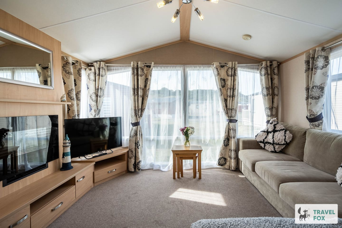
Travel Fox holiday homes around Moray, linked directly to their property pages.
For homeowners
Own a holiday home near Lossiemouth?
We manage holiday lets across the UK from 12% commission, charged after cleaning costs, with no lock-in. A co-founder visits before you decide.
How our holiday let management works →
A guide with a point of view
Written from research. Edited for real journeys.
Use the Official site links for live practical details, then use this guide for context, ideas and room to explore.
Photography credits & licences
Third-party photographs are credited to their named creators and reused under the linked Creative Commons licence or public-domain dedication. Travel Fox stores an optimised local copy; the file-specific changes and any browser-applied display crop are disclosed below. Reused photographs link both to the Wikimedia Commons source record and to the declared source image; Travel Fox's own photographs carry no such record and are marked as ours. These image licences do not cover Travel Fox text, branding or page design.
- File:East Beach, Lossiemouth - geograph.org.uk - 6211645.jpg — photograph by David Purchase; East Beach, Lossiemouth by David Purchase. Source record on Wikimedia Commons. Declared source image. Licence: CC BY-SA 2.0. File changes: Downloaded from Wikimedia Commons, resized to a maximum 1920px edge and encoded as an optimised JPEG. Display changes: Displayed with responsive CSS cropping.
- File:Lossiemouth Fisheries ^ Community Museum - geograph.org.uk - 7671005.jpg — photograph by Richard Sutcliffe; Lossiemouth Fisheries & Community Museum by Richard Sutcliffe. Source record on Wikimedia Commons. Declared source image. Licence: CC BY-SA 2.0. File changes: Downloaded from Wikimedia Commons, resized to a maximum 1920px edge and encoded as an optimised JPEG. Display changes: Displayed with responsive CSS cropping.
- File:Lossiemouth - Station Park - geograph.org.uk - 8110519.jpg — photograph by Colin Smith; Lossiemouth - Station Park by Colin Smith. Source record on Wikimedia Commons. Declared source image. Licence: CC BY-SA 2.0. File changes: Downloaded from Wikimedia Commons, resized to a maximum 1920px edge and encoded as an optimised JPEG. Display changes: Displayed with responsive CSS cropping.
Sources
Every place on this page is checked against a published source. Each entry links the record we used and names who publishes it.
- East Beach — lossiemouth.org other published source
- West Beach — newsroom.moray.gov.uk statutory register or public authority
- Lossiemouth Fisheries & Community Museum — lossiemuseum.co.uk other published source
- Moray Golf Club — moraygolf.co.uk operator, sector body or destination organisation
- Station Park — moray.gov.uk statutory register or public authority
- Lossie Forest — forestryandland.gov.scot statutory register or public authority
- Moray Coast Trail: Hopeman to Lossiemouth — morayways.org.uk operator, sector body or destination organisation