
Under the Downs
Fulking
A chalk-scarp village of spring water, old flint and timber, and footpaths climbing to the South Downs Way.
- Best for
- Downland walks and waterworks history
- Give it
- Half a day, or longer with a second walk
- Don't miss
- The Ruskin-backed fountain and ram house
Photo: AndyScott · CC BY-SA 4.0 · cropped
The Fox verdict
A tiny village with the Downs at its door
Fulking brings together a historic spring-water system, a well-rooted country pub and direct access to the chalk landscape.
Come for a moderate circular walk or a longer contour route, then make time for the fountain and ram house that survive from the water system backed by John Ruskin and Henry Willett. St Andrew's at Edburton, Rushfields at Poynings and Devil's Dyke add credible nearby stops without turning the visit into a long-distance tour.
Where to go
Places in Fulking
Every place below is checked against a published source, listed with what it is and how long to give it.
Local signatures
3 placesThe Shepherd & Dog
A low-ceilinged country pub with bar tables, an annexed barn and a front terrace, serving rotating beers from independent Sussex breweries.
- Visit length
- Editorial estimate: around 90 minutes
- Locality
- at the foot of the Downs
- Access
- Dogs are welcome throughout the pub.
Fulking Pub Walk
A moderate two-mile circular using a steep chalk bostal and the South Downs Way, passing a Victorian lime kiln and the remains of Fulking Isolation Hospital.
- Visit length
- Editorial estimate: around 105 minutes
- Locality
- starting at the Shepherd & Dog
Rushfields Farm Shop
A farm shop, plant centre and café selling local produce, meat, eggs, cheese, handmade pies, ready meals and artisan bread.
- Visit length
- Editorial estimate: around 75 minutes
- Locality
- in Poynings
Walks & outdoors
2 placesFulking Archaeology Walk
A four-mile circular following the contours, with views towards the Weald on one side and the sea on the other.
- Visit length
- Editorial estimate: around 150 minutes
- Locality
- around Fulking
Devil's Dyke
Britain's longest, deepest and widest dry valley, with Iron Age ramparts on its rim and remains from a Victorian funfair.
- Visit length
- Editorial estimate: around 90 minutes
- Locality
- on the South Downs by Fulking
History & heritage
2 placesFulking Waterworks, Fountain and Ram House
The surviving fountain, ram house, pumps and reservoirs belong to the spring-water system backed around 1886 by John Ruskin and Henry Willett.
- Visit length
- Editorial estimate: around 30 minutes
- Locality
- at the bottom of The Street
St Andrew's Church, Edburton
An aisleless 13th-century church with a 14th-century tower and an early lead font decorated with scrolling and trefoiled arcading.
- Visit length
- Editorial estimate: around 45 minutes
- Locality
- in Edburton
No places match this filter. Choose All places to reset the list.
Three ways to explore Fulking
Signature outings
See Ruskin's waterworks
Find the fountain and ram house from the spring-water system backed around 1886 by John Ruskin and Henry Willett.
Read eight centuries in stone
Pause at St Andrew's, almost hidden from the road, and take in its peaceful churchyard.
Trace the Dyke's earthworks
Explore Devil's Dyke, where Iron Age ramparts accompany Britain's longest, deepest and widest dry valley.
The village story
Fulking Village Guide
A spring-fed village tucked below the South Downs, with old waterworks, downland paths and a pub at the foot of the scarp.
Spring Water and the Chalk Scarp
At the bottom of Fulking's one steep street, water runs out of the chalk into a tiled fountain and ram house that stand much as they were built. In 1886 John Ruskin and the Brighton brewer Henry Willett backed a hydraulic-ram system to pump the spring water uphill to the houses; it worked until mains water arrived in 1951, and the pumps, reservoirs and fountain remain largely intact. Esther Meynell, writing in 1947, called it "one of the most glorious springs in Sussex, leaping out of the chalk with a shout."
The village sits tight under the curving chalk scarp, built of flint, cobbles, timber framing and thatch. The Street has been a conservation area since 1984.
A Pub at the Foot of the Downs
The Shepherd & Dog is a low-ceilinged country pub at the foot of the Downs, with bar tables, an annexed barn and a front terrace. It began as two or three cottages and had become a pub by the early 1800s, appearing under its present name in the 1841 census. Sheep were once washed in the stream outside, the likeliest source of the name, and the building was used to hide smuggled goods in a cavity whose location is now lost. Dogs are welcome throughout, and the taps carry beers from independent Sussex breweries that rotate seasonally.
Nearby Poynings has Rushfields, a farm shop, plant centre and café selling local fruit and vegetables, meat, eggs, cheese, handmade pies, ready meals and artisan bread. The café serves full English breakfasts, jacket potatoes, sandwiches and homemade soup.
Walking the High Ground
Walking is the main reason to be here. A two-mile circular from the pub climbs a bostal, the local word for a steep chalk track, onto the South Downs Way, passing a Victorian lime kiln, summer orchids and butterflies, and the remains of the old Fulking Isolation Hospital; allow an hour and a half to two hours. A longer four-mile route follows the contours with the Weald on one side and the sea on the other. About a mile off is Devil's Dyke, the longest, deepest and widest dry valley in Britain, its rim marked by Iron Age ramparts and the remains of a Victorian funfair. Two miles south of Henfield, Woods Mill is a Sussex Wildlife Trust reserve of wetland and woodland with a boardwalk and an all-weather path, open to assistance dogs only.
The Ancient Parish
The parish church stands not in Fulking but along the scarp at Edburton: St Andrew's, thirteenth-century and aisleless, with a fourteenth-century tower and an early lead font worked with scrolling and trefoiled arcading. It has long served as the ancient parish church for both villages; the Domesday surveyors set down Fulking, then Fochinges, as six households, two plough teams and a yearly value of two pounds ten shillings.
Arriving Without a Village Bus
A car is easiest, but bus-and-walk routes exist. The nearest stations, Portslade and Hassocks, are close as the crow flies but leave a long cross-country walk, and no bus reaches the village; the 77 from Brighton stops on the Downs; from there, a mile of the South Downs Way and a descent lead to Fulking. Above the houses, North Town Field has a children's playground.
Stay around South Downs
Make a longer stay of it
Travel Fox holiday homes around South Downs, linked directly to their property pages.
For homeowners
Own a holiday home near Fulking?
We manage holiday lets across the UK from 12% commission, charged after cleaning costs, with no lock-in. A co-founder visits before you decide.
How our holiday let management works →
A guide with a point of view
Written from research. Edited for real journeys.
Use the Official site links for live practical details, then use this guide for context, ideas and room to explore.
Photography credits & licences
Third-party photographs are credited to their named creators and reused under the linked Creative Commons licence or public-domain dedication. Travel Fox stores an optimised local copy; the file-specific changes and any browser-applied display crop are disclosed below. Reused photographs link both to the Wikimedia Commons source record and to the declared source image; Travel Fox's own photographs carry no such record and are marked as ours. These image licences do not cover Travel Fox text, branding or page design.
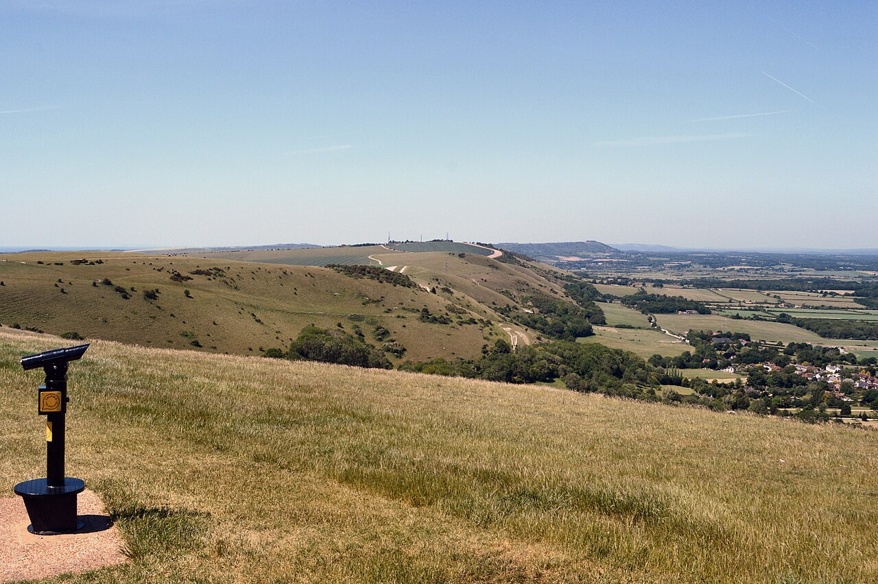
- File:Devil's Dyke, view west over Fulking.jpg — photograph by AndyScott; Own work. Source record on Wikimedia Commons. Declared source image. Licence: CC BY-SA 4.0. File changes: Downloaded from Wikimedia Commons, resized to a maximum 1920px edge and encoded as an optimised JPEG. Display changes: Displayed with responsive CSS cropping.
Sources
Every place on this page is checked against a published source. Each entry links the record we used and names who publishes it.
- The Shepherd & Dog — shepherdanddogpub.co.uk operator, sector body or destination organisation
- Fulking Waterworks, Fountain and Ram House — fulking.net operator, sector body or destination organisation
- Fulking Pub Walk — fulking.net operator, sector body or destination organisation
- Fulking Archaeology Walk — nationaltrust.org.uk national body or asset manager
- St Andrew's Church, Edburton — achurchnearyou.com national body or asset manager
- Rushfields Farm Shop — rushfields.com operator, sector body or destination organisation record not machine-readable; publisher restricts automated access
- Devil's Dyke — nationaltrust.org.uk national body or asset manager