
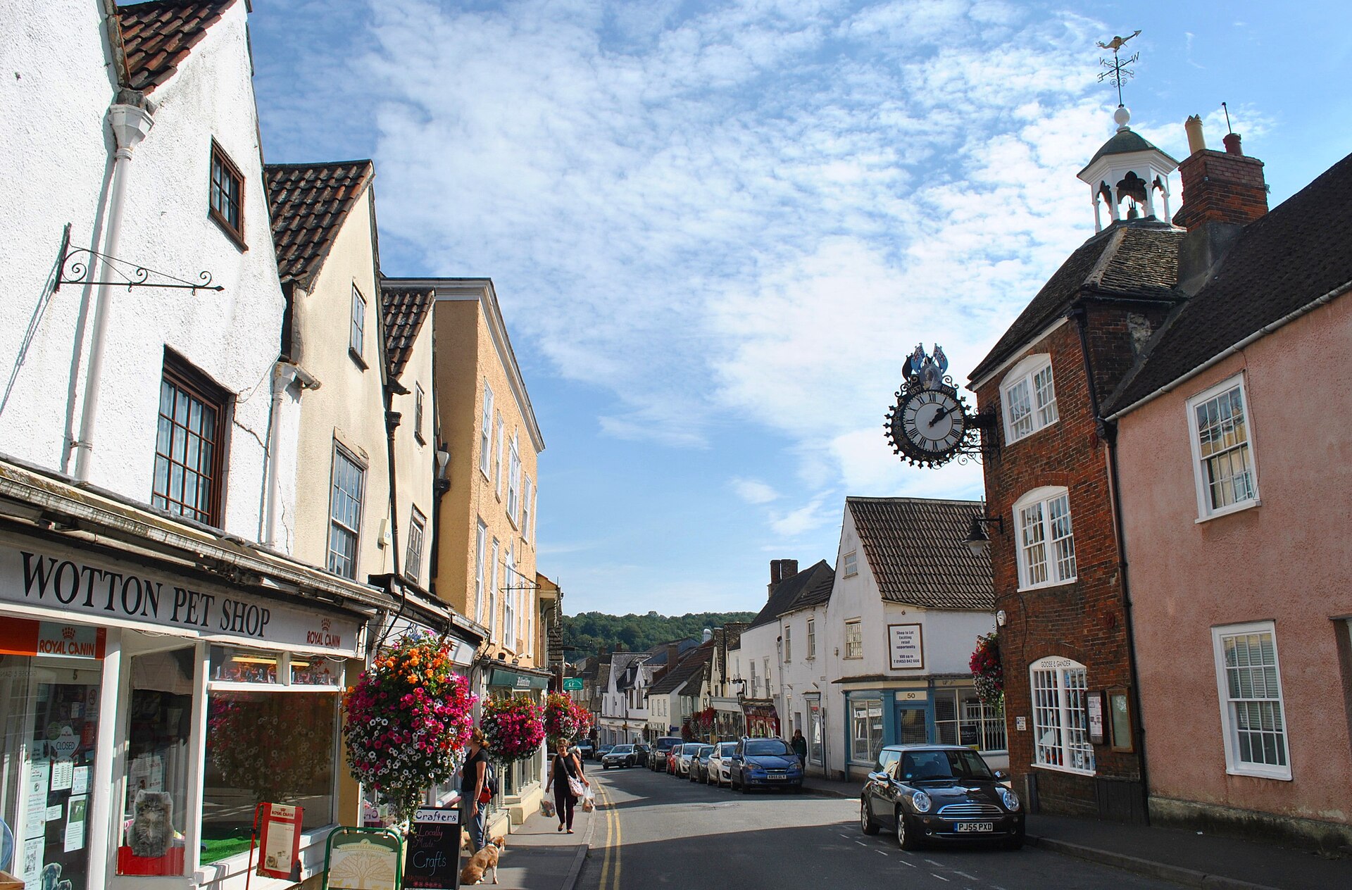
Cotswold escarpment
Wotton-under-Edge
A market town pressed between a wooded scarp and a stream valley, with old streets, proper pubs and a memorable climb to the view.
- Best for
- Hills, history & independent stops
- Give it
- A full day
- Don't miss
- The view from Wotton Hill
Photo: Ray Bird · CC BY-SA 2.0 · cropped
The Fox verdict
A Cotswold town with some grit in its grain.
Wotton-under-Edge is not a museum-piece village. It is a compact working town where wool history, a community cinema, old inns and the steep western escarpment are all within walking distance.
Start in the market streets, then choose your tempo: a long lunch, a film, a wooded climb or an estate walk beyond the town.
Your picks, your pace
Make Wotton yours
Choose a mood or build your own list. The planner keeps the stops in order and gives you a direct map route when you are ready to go.
Local signatures
3 placesWotton-under-Edge Heritage Centre
A former fire station filled with the town's wool, brewing, forestry and Home Front stories, told through a collection of more than 12,000 objects.
- Visit length
- Editorial estimate: 45 min
- Locality
- At The Chipping
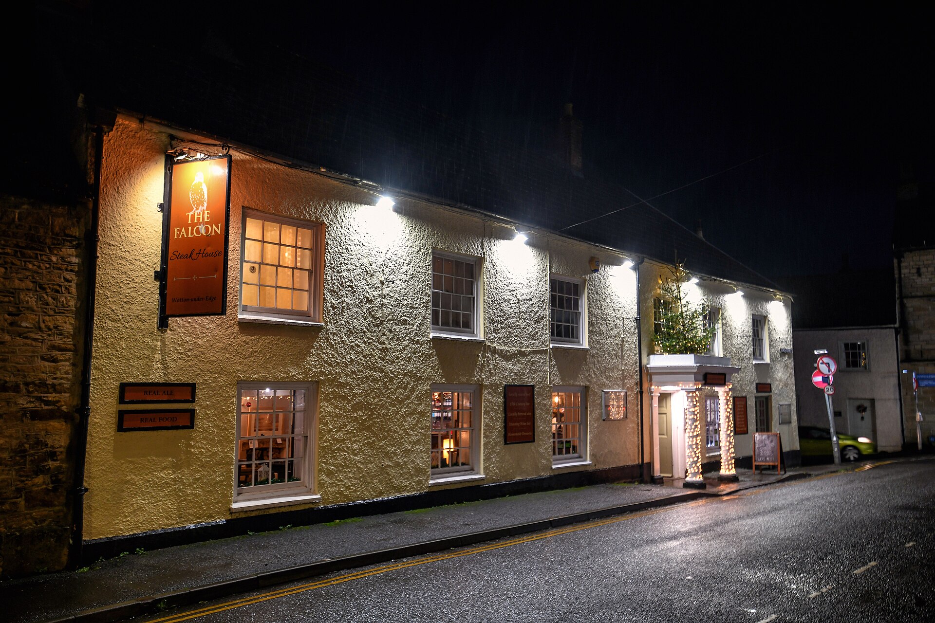
The Falcon Steakhouse
A 1659 Cotswold pub turned steakhouse, known for beef from the Starling family's Ozleworth farm and a menu with real range beyond steak.
- Visit length
- Editorial estimate: 1½ hours
- Locality
- Church Street
- Access
- Booking is advisable for dining; check the Official site before travel.
Wotton Electric Picture House
A community-run cinema in the former Crown Inn, where a 1913 picture house and a later stable-yard auditorium found a second life together.
- Visit length
- Editorial estimate: 2 hours
- Locality
- Market Street
- Access
- Programme and ticket availability vary; check the Official site before travel.
Walks & outdoors
3 placesWotton Hill and Jubilee Clump
A pine-crowned rise inside a Site of Special Scientific Interest, with the Severn Vale and Wales opening out beyond the roofs of Wotton.
- Visit length
- Editorial estimate: 1½ hours
- Locality
- Above the town
- Access
- The climb is steep and paths can be muddy; wear suitable footwear.
The Conygre
Fifteen and a half acres of ancient broadleaved woodland, principally beech and ash, with steps that make the slope part of the experience.
- Visit length
- Editorial estimate: 1 hour
- Locality
- West of the centre
- Access
- Stepped woodland paths are uneven and can be slippery after rain.
Newark Park
A Tudor hunting lodge transformed into a Georgian home, set in a large estate with waymarked walks, play areas and long western views.
- Visit length
- Editorial estimate: 2½ hours
- Locality
- Near Ozleworth
- Access
- House and estate access are seasonal; check the Official site before travel.
History & heritage
2 places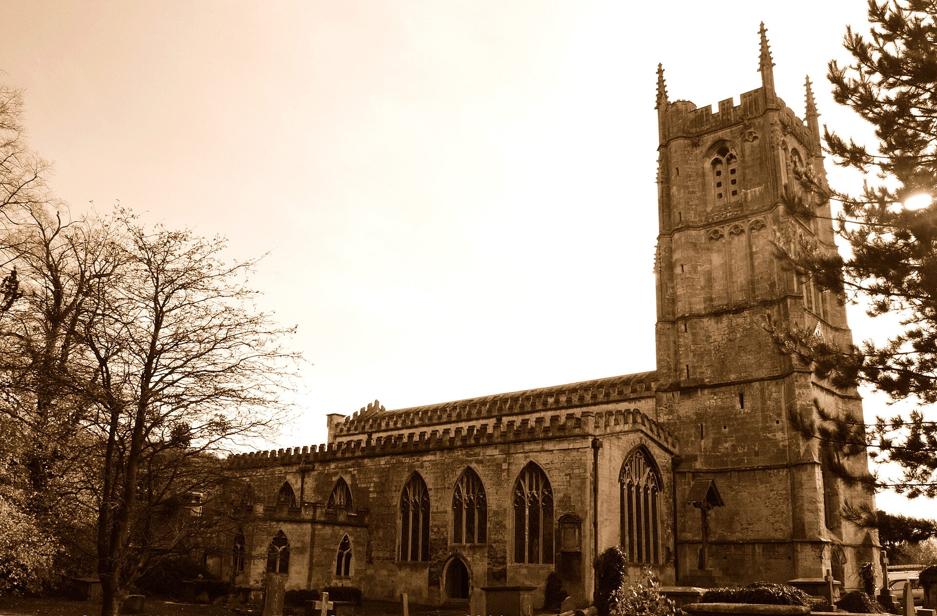
Church of St Mary the Virgin
A Grade I parish church whose arcades, tower, porch and chancel make a compact walk through several centuries of Wotton's history.
- Visit length
- Editorial estimate: 45 min
- Locality
- Church Street
- Access
- Church access can vary with services and events; check the Official site before travel.
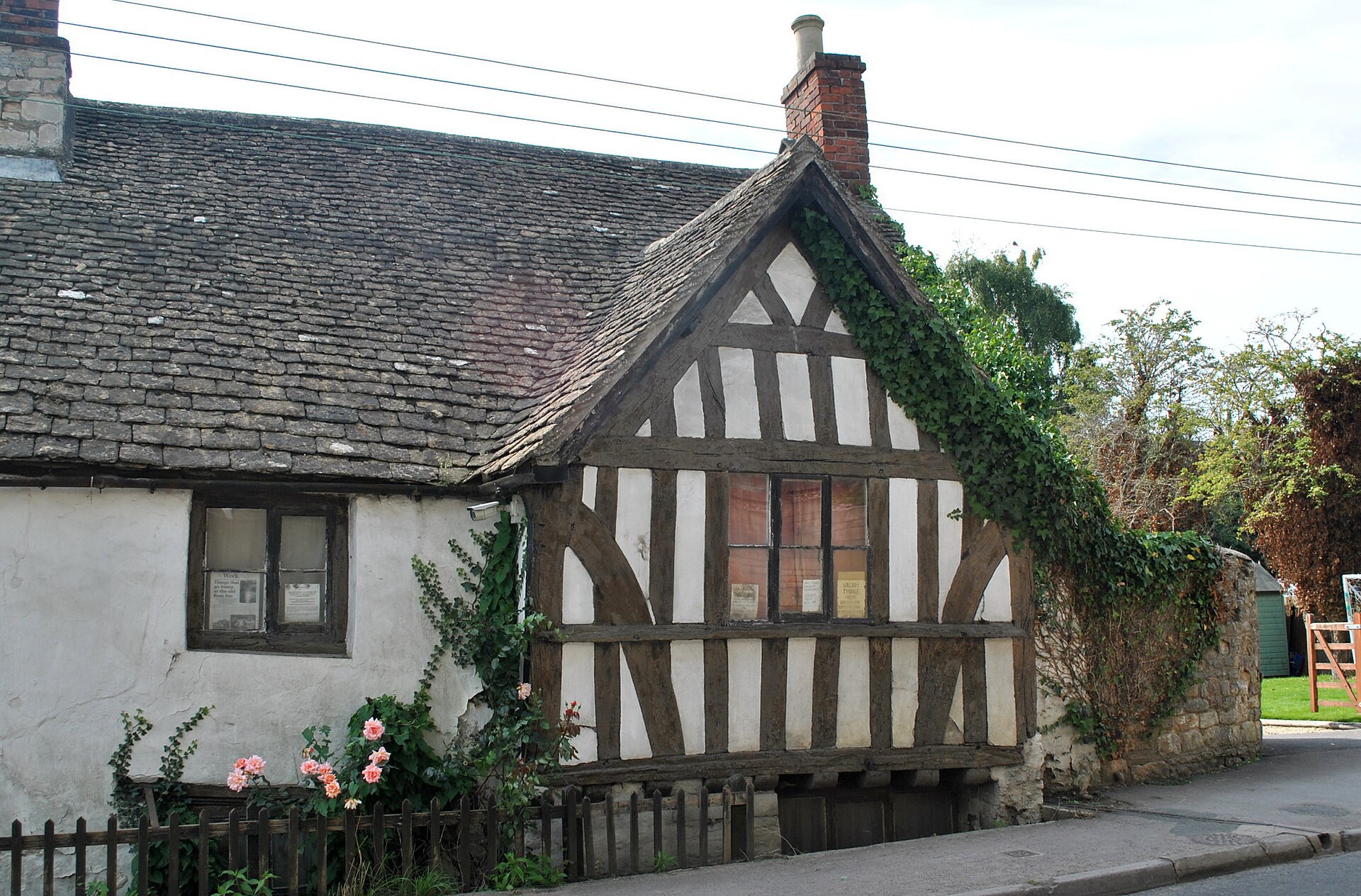
The Ancient Ram Inn
A Grade II* late-medieval inn with a first-floor hall, substantial sixteenth-century remodelling and tangible links to Wotton's wool trade.
- Visit length
- Editorial estimate: 45 min
- Locality
- Potters Pond
- Access
- Visits are by arranged tour or event; check the Official site before travel.
No places match this filter. Choose All places to reset the list.
On the map
Wotton-under-Edge at a glance
Tap a marker to jump to its guide card.
Three ways to explore Wotton-under-Edge
Signature outings
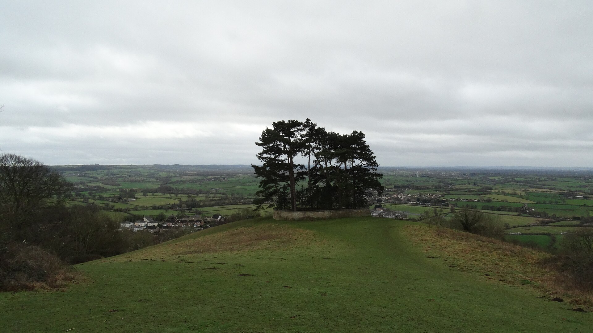
Climb to the pines
Take the steep way up to Jubilee Clump for the town below and the Severn Vale beyond.
Make a meal of it
Book a table at the Falcon for a relaxed dinner rooted in the farming country above town.
Step inside the church
Read the town's changing story in St Mary's arcades, tower, porch and chancel.
The town story
A town made by the hill
The most useful way to understand Wotton-under-Edge is to walk from its busy streets to the rim of the escarpment: wool town, market town, cinema town, then suddenly open country.
A market town, not a backdrop
Wotton's streets make the first point clearly: this is a market town, not a Cotswold stage set. Medieval lines still shape the centre, while late-medieval, Jacobean, Regency and early-Victorian buildings stand close enough to turn an ordinary errand into a history walk. The western escarpment rises immediately behind them; a stream valley runs through the lower ground.
The town council dates borough and market status to 1252. Wool followed, first through domestic work in cottages and later through the town's seventeenth- and eighteenth-century industrial peak. Bigger industry sought better transport elsewhere, leaving central Wotton with an unusually readable mix of old fabric and practical independent trade.
That working character is still the point of a wander. Bakers, food shops, a book room, makers and familiar pub doors sit among the older frontage, so the centre rewards browsing rather than a single lap for photographs. The Falcon is one end of the food story; elsewhere the town has the sort of useful local stops that make a picnic, an everyday lunch or a last-minute present easy to assemble.
The Heritage Centre gives that story a useful human scale. Its former fire-station setting holds objects connected with wool, brewing, forestry and the Home Front, so a short visit adds context before the street names and old shopfronts start doing their work.
Church, cloth and a remarkable inn
St Mary's is Grade I and conspicuously layered: thirteenth-century arcades, a fourteenth-century west tower, a mostly fifteenth-century body, a later porch and a nineteenth-century chancel. The carved foliage capitals and memorial brasses reward an unhurried look rather than a quick photograph from the churchyard.
Near the church stands the Ancient Ram Inn, Grade II* and securely late medieval in its fabric, with major sixteenth-century remodelling. Tenter hooks and documents connect it to Wotton's wool merchants; its first-floor hall still makes the building's domestic scale feel striking. Tours put the emphasis on atmosphere, but the building itself is the real draw.
The Falcon takes the story forward into a different kind of local continuity. Its 1659 building turns the corner from Church Street onto Ludgate Hill; its kitchen works with beef from the Starling family's farm at Ozleworth. It is the sort of place where a history walk can end with a serious meal rather than a token cream tea.
The show kept going
Wotton Cinema began when William and Mrs Coe bought the de-licensed Crown Inn and opened the Electric Picture House in its upstairs banqueting room in 1913. The former stables became a larger auditorium in 1921, and sound arrived in 1930. The building has since carried boxing, bingo and cinema again, gathering useful layers rather than losing them.
Its community-cooperative return makes it more than a rainy-day option. A film here is a small piece of the town's habit of finding new purposes for old rooms, and it sits close enough to the pubs, shops and church for an easy town-centre afternoon.
The hill changes the scale
Wotton Hill is the immediate escape. Jubilee Clump mixes Scots and Corsican pines within a Site of Special Scientific Interest, and its western view runs across the Severn Vale towards Wales. The pines carry their own commemorative history, from a Waterloo planting to later jubilee replantings, but the main pleasure is the sudden breadth after the town's close streets.
The contrast is the lasting memory: one minute a lane is edged by stone walls and shop windows, and soon the land falls away below the pines. It is worth allowing enough time to pause rather than treating the hill as a quick viewpoint. The weather moves visibly across the Vale, while the wooded scarp explains why the town's streets feel both sheltered and tightly drawn together.
For a lower, shadier alternative, the Conygre is a steep patch of ancient broadleaved woodland, chiefly beech and ash. Beyond town, Newark Park carries the Cotswold Way through a much larger estate around a Tudor hunting lodge transformed into a Georgian home. Together they explain why Wotton feels compact without ever feeling enclosed.
Stay around Cotswolds
Make a longer stay of it
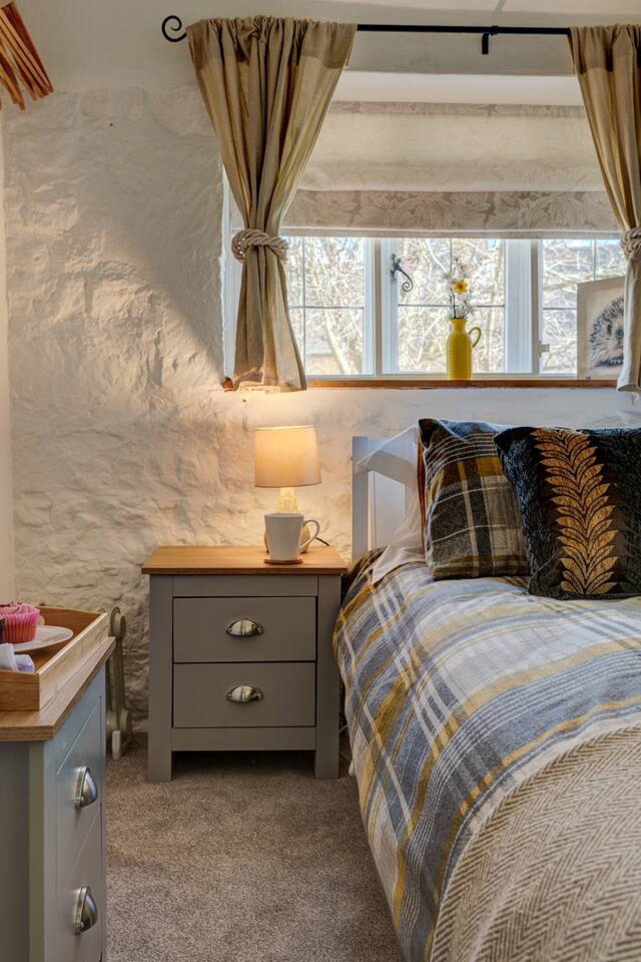
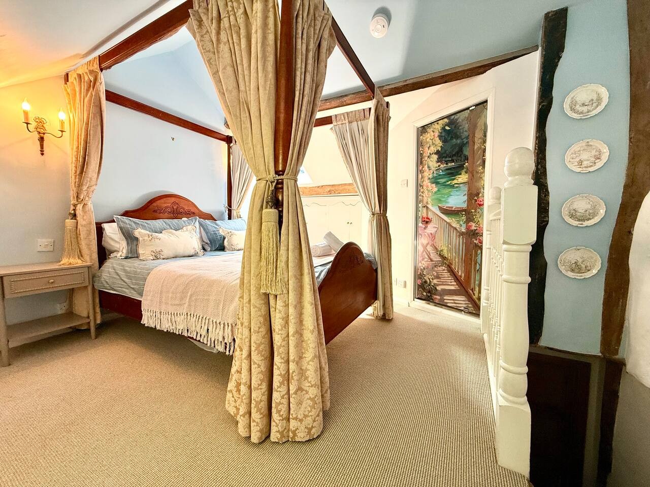
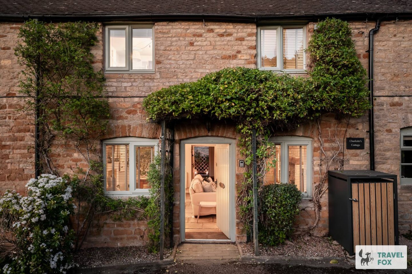
Travel Fox holiday homes around Cotswolds, linked directly to their property pages.
For homeowners
Own a holiday home near Wotton-under-Edge?
We manage holiday lets across the Cotswolds from 12% commission, charged after cleaning costs, with no lock-in. A co-founder visits before you decide.
Holiday let management in the Cotswolds →
A guide with a point of view
Written from research. Edited for real journeys.
Use the Official site links for live practical details, then use this guide for context, ideas and room to explore.
Photography credits & licences
Third-party photographs are credited to their named creators and reused under the linked Creative Commons licence or public-domain dedication. Travel Fox stores an optimised local copy; the file-specific changes and any browser-applied display crop are disclosed below. Reused photographs link both to the Wikimedia Commons source record and to the declared source image; Travel Fox's own photographs carry no such record and are marked as ours. These image licences do not cover Travel Fox text, branding or page design.
- File:High Street-Long Street, Wotton Under Edge, Gloucestershire 2015 - geograph.org.uk - 5800675.jpg — photograph by Ray Bird; © Ray Bird. Source record on Wikimedia Commons. Declared source image. Licence: CC BY-SA 2.0. File changes: Copied without byte modification from Wikimedia's declared rendition. Display changes: Displayed with CSS cropping.
- File:Tree clump on Wotton Hill above Wotton under Edge - geograph.org.uk - 5607209.jpg — photograph by Colin Park; © Colin Park. Source record on Wikimedia Commons. Declared source image. Licence: CC BY-SA 2.0. File changes: Copied without byte modification from Wikimedia's declared rendition. Display changes: Displayed with CSS cropping.
- File:Wotton-Under-Edge , The Falcon Steakhouse - geograph.org.uk - 7669584.jpg — photograph by Lewis Clarke; © Lewis Clarke. Source record on Wikimedia Commons. Declared source image. Licence: CC BY-SA 2.0. File changes: Copied without byte modification from Wikimedia's declared rendition. Display changes: Displayed with CSS cropping.
- File:St Mary's Church, Wotton Under Edge, Gloucestershire 2014 - geograph.org.uk - 5800990.jpg — photograph by Ray Bird; © Ray Bird. Source record on Wikimedia Commons. Declared source image. Licence: CC BY-SA 2.0. File changes: Copied without byte modification from Wikimedia's declared rendition. Display changes: Displayed with CSS cropping.
- File:The Ram Inn (closed), Wotton Under Edge, Gloucestershire 2015 - geograph.org.uk - 5793361.jpg — photograph by Ray Bird; © Ray Bird. Source record on Wikimedia Commons. Declared source image. Licence: CC BY-SA 2.0. File changes: Copied without byte modification from Wikimedia's declared rendition. Display changes: Displayed with CSS cropping.