
High ground, long memory
Shap
A moorland village shaped by prehistoric stones, a remote abbey and the old road to Scotland.
- Best for
- Upland walking and layered history
- Give it
- A half day on foot
- Don't miss
- The farm-track approach to Shap Abbey
Photo: Rude Health · CC BY-SA 2.0 · cropped
The Fox verdict
A village for walkers who like history in the landscape
Shap trades postcard lakes for open moorland, a storied main road and unusually deep traces of the past.
Come for Shap Abbey beside the River Lowther, then look further back at Oddendale's surviving stone circle. The Coast to Coast Walk brings the upland setting into the village itself, while The Greyhound recalls the years when the A6 made Shap a staging post on the road to Scotland.
Where to go
Places in Shap
Every place below is checked against a published source, listed with what it is and how long to give it.
Local signatures
3 placesShap Abbey
Remote Premonstratensian ruins with mostly 13th-century fabric and a striking early 16th-century west tower.
- Visit length
- Editorial estimate: Allow around 90 minutes
- Locality
- beside the River Lowther west of Shap
- Access
- The ruins are approached along a farm track.
Oddendale Stone Circle
A small intact stone circle that preserves part of Shap's much larger prehistoric landscape.
- Visit length
- Editorial estimate: Allow around 60 minutes
- Locality
- at Oddendale, southeast of Shap
Coast to Coast Walk
Alfred Wainwright's long-distance route crosses Shap, giving the village a natural place in a day on foot.
- Visit length
- Editorial estimate: Allow around 2 hours for a local stretch
- Locality
- passing through Shap
Food & drink
1 place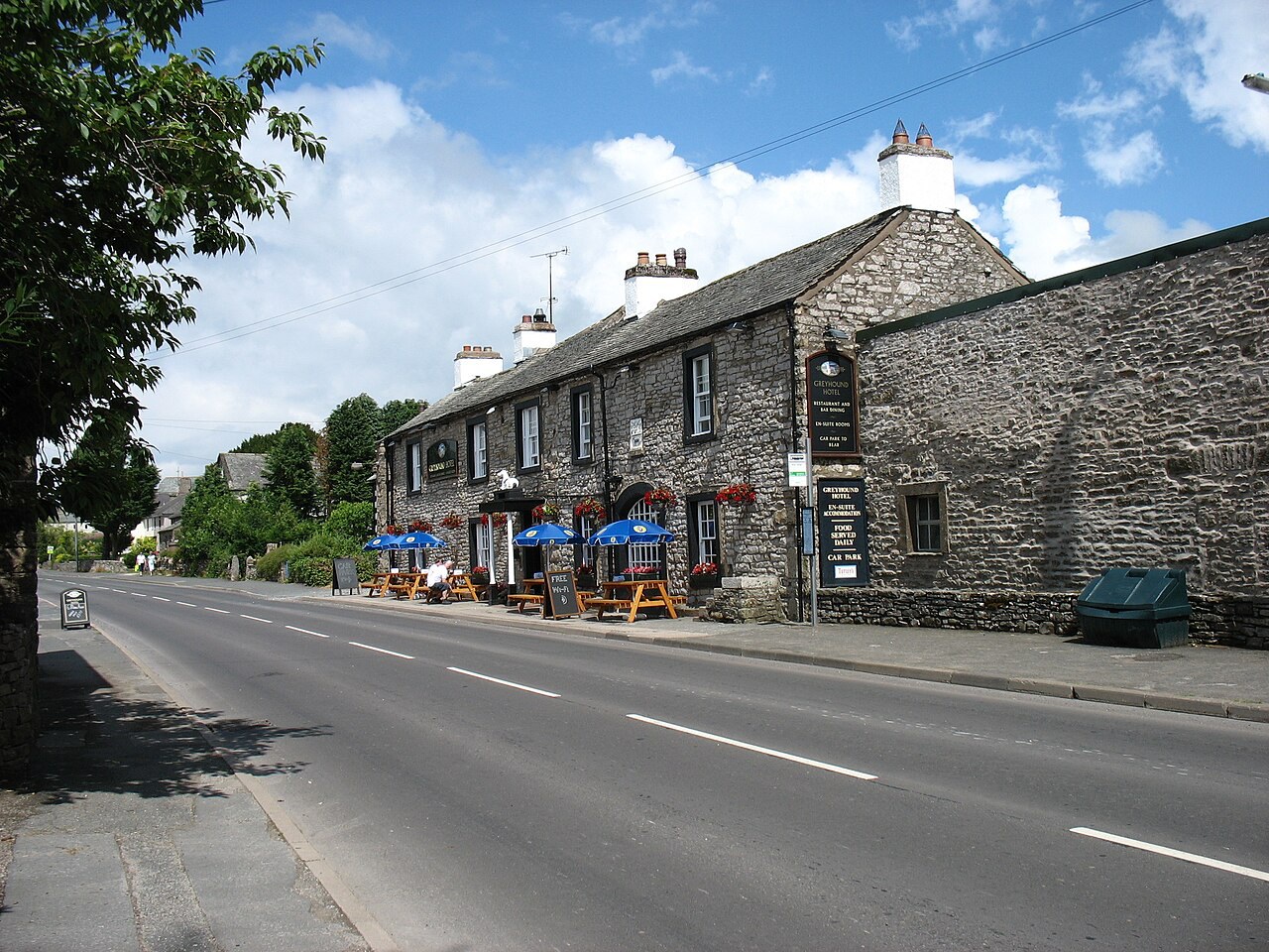
The Greyhound Hotel
A renovated 18th-century coaching inn with a restaurant and bar, surviving from Shap's years as a staging post.
- Visit length
- Editorial estimate: Allow around 75 minutes
- Locality
- on the A6 in Shap
- Access
- Menu detail and visitor facilities are not documented in the copied evidence; check local visitor information before travel.
History & heritage
1 place
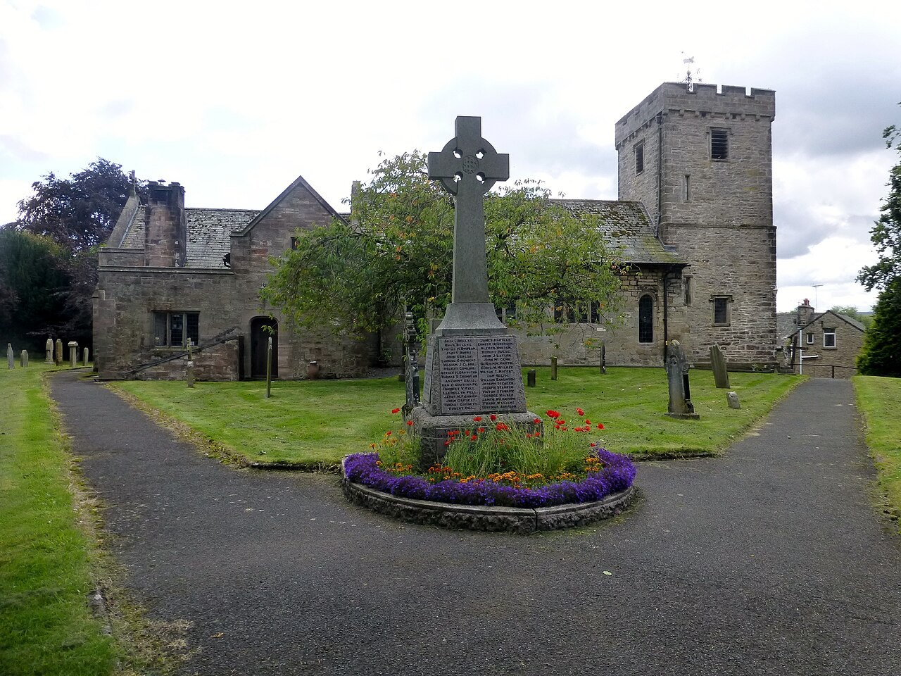
St Michael's Church, Shap
Shap's medieval church offers a compact pause among the village's deeper historical layers.
- Visit length
- Editorial estimate: Allow around 30 minutes
- Locality
- in Shap village
- Access
- Check the official church page before planning an interior visit.
No places match this filter. Choose All places to reset the list.
Three ways to explore Shap
Signature outings
Visit St Michael's Church
Visit Shap's medieval church for a compact historical pause in the village.
Find the surviving circle
Visit Oddendale for the small surviving stone circle, about 2.3 miles from Shap in a straight line; the journey on foot is longer.
Refuel at a coaching inn
Call at The Greyhound's restaurant and bar, a renovated survivor from the A6 staging-post years.
The village story
Shap Village Guide
A high Cumbrian village where coaching roads, monastic ruins and prehistoric stones meet the long-distance path.
Coaching Roads and High Ground
The Greyhound Hotel stands on the A6 where it has stood, in one form or another, since 1680. It is an 18th-century coaching inn, since renovated, and one of the survivors from the days when Shap was a staging post rather than a place you drive past. The bar looks out over the surrounding fells. Shap Abbey lies beyond the village to the west.
Shap sits high, on a limestone plateau east of the main Lake District fells, with Shap Fell rising to 1,328 feet above the village. This is open upland — moorland and dramatic country on the edge of the Eden Valley limestone, rather than the postcard lakes a few miles west. The weather up here has opinions.
The Road that Made Shap
The A6 that runs through the village used to be one of England's hardest main roads. Before the M6, the route over Shap Fell at 1,400 feet was the way to Scotland, and it was notorious for fog, ice and breakdowns. The village kept numerous coaching inns going to catch the traffic. Then the M6 opened through Shap in 1970, took the traffic away, and the village's economy declined sharply. The motorway and the West Coast Main Line both thread the Lune Gorge below the village, a stretch of ground engineers have been wrestling with for a long time.
Shap Abbey by the Lowther
The walking is the reason to be here. About a mile west of the village, beside the River Lowther, are the ruins of Shap Abbey — free to visit, an English Heritage site, and one of the more remote and atmospheric monastic ruins in the country. It was a Premonstratensian house, founded near Kendal around 1190 and moved to Shap in 1199. It has one distinction that outlasts all the others: it was the last abbey in England dissolved by Henry VIII, surrendered on 14 January 1540. Most of what stands is 13th century; the tall west tower is early 16th. After the Dissolution the buildings were folded into a farm, which is why you approach the ruins along a farm track.
Stone Circles and Long-Distance Feet
There is older ground still. About 2.3 miles southeast of Shap in a straight line, at Oddendale, is a small stone circle that has survived intact. The journey on foot is longer. It is a fragment of something once enormous: the Shap Stone Avenue ran for nearly two miles northwest from the Kemp Howe circle, part of one of the largest megalithic complexes in Europe, comparable to Avebury before it was pulled apart. Most of the stones were broken up between the 17th and 19th centuries for building material — some of it, it is said, going into Shap Abbey, and later into houses. Wainwright's Coast to Coast walk passes straight through the village, so you may find yourself sharing the pavement with people who have walked a very long way.
A Village Beyond the Timetable
There is no station; the nearest is Penrith, ten miles north. But the fells were here first, and they will outlast the timetable.
Stay around Lake District
Make a longer stay of it
Travel Fox holiday homes around Lake District, linked directly to their property pages.
For homeowners
Own a holiday home near Shap?
We manage holiday lets across the Lake District from 12% commission, charged after cleaning costs, with no lock-in. A co-founder visits before you decide.
Holiday let management in the Lake District →
A guide with a point of view
Written from research. Edited for real journeys.
Use the Official site links for live practical details, then use this guide for context, ideas and room to explore.
Photography credits & licences
Third-party photographs are credited to their named creators and reused under the linked Creative Commons licence or public-domain dedication. Travel Fox stores an optimised local copy; the file-specific changes and any browser-applied display crop are disclosed below. Reused photographs link both to the Wikimedia Commons source record and to the declared source image; Travel Fox's own photographs carry no such record and are marked as ours. These image licences do not cover Travel Fox text, branding or page design.
- File:St Michael's Church, Shap - geograph.org.uk - 4128007.jpg — photograph by Rude Health; St Michael's Church, Shap by Rude Health. Source record on Wikimedia Commons. Declared source image. Licence: CC BY-SA 2.0. File changes: Downloaded from Wikimedia Commons, resized to a maximum 1920px edge and encoded as an optimised JPEG. Display changes: Displayed with responsive CSS cropping.
- File:The Greyhound Hotel, Shap - geograph.org.uk - 3589141.jpg — photograph by David Purchase; The Greyhound Hotel, Shap by David Purchase. Source record on Wikimedia Commons. Declared source image. Licence: CC BY-SA 2.0. File changes: Downloaded from Wikimedia Commons, resized to a maximum 1920px edge and encoded as an optimised JPEG. Display changes: Displayed with responsive CSS cropping.
Sources
Every place on this page is checked against a published source. Each entry links the record we used and names who publishes it.
- Shap Abbey — english-heritage.org.uk national body or asset manager
- Oddendale Stone Circle — historicengland.org.uk statutory register or public authority record not machine-readable; publisher restricts automated access
- Coast to Coast Walk — gov.uk statutory register or public authority
- St Michael's Church, Shap — carlislediocese.org.uk national body or asset manager
- The Greyhound Hotel — shapcumbria.wordpress.com other published source