

Where waterways and stories meet
Great Haywood
Cross an Elizabethan-era packhorse bridge, watch two canals converge and follow Great Haywood's links to Shugborough and Tolkien.
- Best for
- Canal walks, layered history and an easy pub stop
- Give it
- A relaxed half day, or longer with Shugborough
- Don't miss
- The fourteen surviving arches of Essex Bridge
Photo: Greg Pearce / Gjp23 at en.wikipedia · CC BY-SA 3.0 · cropped
The Fox verdict
A small village at a remarkable crossroads
Great Haywood brings a packhorse bridge, two canals, two distinctive churches and a strong food stop into an unusually compact visit.
The pleasure is in the connections: Essex Bridge leads across the Trent towards Shugborough, Haywood Junction gathers boats where the canals meet, and Main Road holds both the village churches and the Clifford Arms. Canalside Farm makes the towpath useful for lunch as well as walking, while the Wolseley Centre adds a nearby family nature stop.
Your picks, your pace
Make Great Haywood yours
Choose a mood or build your own list. Your saved stops are an ordering aid, with a direct map route when you are ready.
Local signatures
3 places
Start here
Essex Bridge
Walk the low Grade I-listed stone span, where fourteen arches survive from a bridge once described as having forty-three.
- Visit length
- Editorial estimate: allow around 30 minutes
- Locality
- across the River Trent beside Shugborough
Canalside Farm, Shop & Cafe
A family-run farm shop, butcher, deli, bakery and cafe, with canal views and seasonal pick-your-own fruit and pumpkins.
- Visit length
- Editorial estimate: allow around 75 minutes
- Locality
- Mill Lane beside the Trent & Mersey Canal
- Access
- Pick-your-own fruit and pumpkins are seasonal; check the Official site before travel.
St John the Baptist Catholic Church
Built as Tixall Hall's private chapel, the church was dismantled and rebuilt here in the 1840s; reassembly marks remain visible inside.
- Visit length
- Editorial estimate: allow around 30 minutes
- Locality
- Main Road
Food & drink
1 placeThe Clifford Arms
A traditional village inn with cask ales, a broad food menu, a log fire, a beer garden and a long history of serving boaters, walkers and cyclists.
- Visit length
- Editorial estimate: allow around 75 minutes
- Locality
- Main Road
- Access
- Children are welcome; check the Official site for current family access and food service.
Walks & outdoors
2 places
Haywood Junction
Watch narrowboats negotiate the meeting of two canals at a junction formed within James Brindley's Grand Cross network.
- Visit length
- Editorial estimate: allow around 30 minutes
- Locality
- where the Trent & Mersey and Staffordshire & Worcestershire canals meet
Tixall Wide
Follow the canal to a broad, lake-like stretch deliberately widened to preserve the former Tixall House outlook, with Tixall Gatehouse nearby.
- Visit length
- Editorial estimate: allow around 60 minutes
- Locality
- along the Staffordshire & Worcestershire Canal towpath
History & heritage
2 placesSt Stephen's Church
The nineteenth-century parish church has corbels and bosses by Great Haywood-born sculptor Samuel Peploe Wood and Anson family graves in its churchyard.
- Visit length
- Editorial estimate: allow around 30 minutes
- Locality
- Main Road

Shugborough Estate
Explore the Anson family's ancestral estate, including the mansion, museum, walled kitchen garden, formal gardens and working model farm.
- Visit length
- Editorial estimate: allow around 150 minutes
- Locality
- across Essex Bridge from Great Haywood
Things to do
1 placeThe Wolseley Centre
Staffordshire Wildlife Trust's headquarters offers twenty-six acres of woodland, lakes and marsh, plus a lakeside cafe and learning hub.
- Visit length
- Editorial estimate: allow around 120 minutes
- Locality
- at Wolseley Bridge
No places match this filter. Choose All places to reset the list.
On the map
Great Haywood at a glance
Tap a marker to jump to its guide card.
Three ways to explore Great Haywood
Signature outings
Walk Essex Bridge
Take the traffic-free packhorse bridge slowly, counting its fourteen surviving low stone arches with Shugborough across the water meadows.
Open up Shugborough
Move from mansion and museum to the walled kitchen garden and working model farm on the Ansons' historic estate.
Pause at the junction
See narrowboats gather where the Trent & Mersey meets the Staffordshire & Worcestershire Canal.
The village story
Great Haywood Village Guide
A village shaped by converging rivers, canals, estate history and Tolkien's wartime stay.
Bridge, Junction and Village Inn
Essex Bridge crosses the River Trent in fourteen low stone arches, which sounds unremarkable until you learn it once had something closer to forty-three. It was built for the Earl of Essex, a favourite of Elizabeth I, and was already old enough to need repair by 1583. A 1679 account describes it being rebuilt in stone after an earlier wooden bridge collapsed. What survives today — Grade I listed, fourteen arches, low enough that a laden packhorse could cross without ducking — is reckoned the longest surviving packhorse bridge in England. It carries no traffic now. You walk it, slowly, with Shugborough Hall visible across the water meadows on the far bank.
The village sits where the Trent meets its tributary the Sow, on the northern edge of the Cannock Chase Area of Outstanding Natural Beauty. It is also where two canals meet: James Brindley's Trent & Mersey, finished through here in the 1770s, joins the Staffordshire & Worcestershire Canal at Haywood Junction, a few hundred yards from the bridge. Arrive on foot along the towpath and you get moored narrowboats stacked three and four deep at the junction itself, then thin out fast the further you walk. Andy Tidy, who writes as the "Canal Curator," has described the pattern well: "sometimes you pass through mile after mile of nothingness with hardly a boat in sight, and then suddenly you arrive at a canal intersection to find it absolutely rammed with moored craft."
The Clifford Arms, on Main Road, is the pub to know. It started as a gatehouse to the Anson family's Shugborough estate, became a pub by 1818, and was rebuilt by Bass in 1930, so what you're drinking in now is largely a 1930s room with older bones and a wall of photographs of the pub through the decades. The menu runs from sandwiches, baguettes and jacket potatoes up through a Ploughman's Lunch, Red Chilli & Ginger Chicken Goujons, something called the Clifford Crunchie, and steaks and grills, with vegetarian and gluten-free options alongside. The thing people actually talk about is the hot beef sandwich — thick white bloomer, garlic butter, a serious quantity of beef. "Best beef sandwiches I have ever had," runs one Tripadvisor review, which for a pub sandwich is a high bar to clear. Three permanent cask ales — Adnams Ghost Ship, Draught Bass, Wainwright Gold — plus three rotating guests, and the place is Cask Marque accredited. There's a log fire for cold days, a beer garden, dogs welcome in both, and a quiz team, a dominoes team and a classic car and bike club that treat it as a base. Children are welcome until 8pm, and the restaurant runs 6-9pm daily plus lunchtimes at weekends. It has been a stopping point for boaters, walkers and cyclists off the Trent & Mersey for the better part of two centuries, which is a long time for anywhere to hold a reputation, let alone keep it.
Village Tables and Two Churches
The village's other licensed venue is the Sports & Social Club, also on Main Road, in a building the 2nd Earl of Lichfield originally put up as a Working Men's Reading Room and Library — some accounts trace that use back to 1869, though the club in its current form is closer to forty-five years old. Non-members can sign in at reception. There's darts, dominoes, cribbage, snooker, pool, sports-league teams, and Saturday nights given over to karaoke, a disco or live music, with Doom Bar and a changing guest beer at the bar. It is not trying to be the Clifford Arms, and doesn't need to be.
For food beyond the pubs, Canalside Farm sits directly on the Trent & Mersey towpath by the junction — a working farm shop with its own deli, butcher, bakery and homewares, open seven days, 9am to 5pm. The farm is known regionally for its strawberries and other soft fruit, supplied to catering and retail businesses across Staffordshire, and in summer you can pick your own strawberries, raspberries and blackberries, with pumpkins in the autumn. The cafe seats seventy-two inside and forty on a canal-view terrace, does all-day breakfasts, seasonal lunches and a traditional afternoon tea, and sources what it can from the farm itself or from suppliers within thirty miles. It has picked up awards for it. There's a post office too, on Main Road, doing the ordinary business a village post office does.
There are two churches, and they tell different stories. St Stephen's, the parish church, dates from 1840, designed by the local architect Thomas Trubshaw for the 2nd Earl of Lichfield and largely rebuilt in 1858. Its corbels and bosses were carved by Samuel Peploe Wood, a sculptor born in the village in 1827, and the churchyard holds the graves of three Earls of Lichfield and other members of the Anson family from Shugborough. The Roman Catholic church of St John the Baptist has a stranger history: built in 1827-9 as the private chapel of Tixall Hall for the Clifford family, it was dismantled when the family left Tixall in the 1840s and rebuilt, stone by stone, on its present site in Great Haywood — the reassembly marks are still visible inside. It was here, in May 1916, that J.R.R. Tolkien and his wife Edith received a nuptial blessing.
Paths, Old Haywood and the Ansons
Walking out from the village, the obvious route is the Tolkien Trail — a roughly 4.7-mile circular up into Cannock Chase and back, largely flat through the village and Shugborough Park before it climbs past Brocton Coppice and the Sherbrook Valley, with its stepping stones, and returns across Essex Bridge. Allow two to two and a half hours. Shorter and flatter is the Canal & River Trust's Great Haywood "Wellbeing Walk," a loop of similar length along both canal towpaths past the junction and the farm cafe. West along the Staffs & Worcester Canal you reach Tixall Wide, a stretch deliberately widened by the canal's builders to look like a lake, so as not to spoil the view from the now-vanished Tixall House — the surviving Tixall Gatehouse still stands beside it. And if you fancy stretching your legs further, Little Haywood is a short, level walk along the Trent, close enough that the two villages are often treated as one.
The Domesday survey of 1086 records Great and Little Haywood together: fifteen households — nine villagers, five smallholders and a priest — ten ploughlands, two leagues of woodland, six acres of meadow and a mill worth five shillings. The whole was valued at two pounds to the lord, the Bishop of Chester, in both 1066 and 1086, which tells you roughly how much this stretch of the Trent valley was worth to anyone before the canals arrived. The village had its own mill and brewery once; both are long gone, and survive only as local road names. A car accident here in 1905 was serious enough that the village mill pond was drained and the road through the centre straightened afterwards. A railway station finally opened in 1887, on the Stone-to-Colwich line, and closed in 1947 — by 1941 wartime cuts had already reduced it to a single train a day with no way back. The A51 bypass, opened in 1964, took the through-traffic out of the village for good.
The Ansons bought Shugborough in 1624 and held it for three centuries. When Thomas Anson inherited in 1720 he demolished the old estate village that stood in the way of his park and rehoused its people across the river, in new cottages in what became Great Haywood — which is to say the village you're standing in is, in part, the overspill of somebody else's landscaping decision.
Tolkien, the Cliffs and a Lost Pub
Edith Tolkien moved here in the spring of 1916, with her cousin Jennie Grove, to be near her husband's army camp on Cannock Chase, and lived here until early 1917, most likely at what is now called Rock Cottage, near the old Reading Room. Tolkien himself came back to recuperate with her over the winter of 1916-17, invalided home with trench fever, at a cottage at Gipsy Green on the nearby Teddesley Park Estate, and it was there that he began writing what would become The Silmarillion. In his early mythology he turned the confluence of the Trent and the Sow at Essex Bridge into "Tavrobel," where two invented rivers meet, and Shugborough Hall is thought to be the model for the "House of a Hundred Chimneys" — it actually has around eighty, a discrepancy one Tolkien-trail blogger has called "prone to a little bit of hyperbole."
The land above the village, on the Shugborough estate, shows signs of old small-scale stone quarrying and is still known locally as "the cliffs," or sometimes "the caves" — the underlying rock is Triassic sandstone with glacial deposits on top. In August 2002 those cliffs briefly made the national press: adverts in The Guardian, The Stage, the London Review of Books and the Staffordshire Newsletter sought an "ornamental hermit" to live in a tent up there for a single weekend, as part of an art exhibition called "Solitude." Around 250 people applied. The job went to the artist Ansuman Biswas.
There used to be a third pub, the Staffordshire Knot — known earlier as the Tiger, under a licensee called Lewis Biddulph from around 1820 — which closed in the late 1960s. Its last landlady, Isabella "Bel" Arnott, ran it until the end and died in Congleton in 1989. The building is still there, now a private house, and still carries the name: The Knot.
Towpaths, Estates and Dusk
Families tend to gravitate to the flat towpaths in both directions from the junction, easy going with a buggy or a bike, and to Canalside Farm's pick-your-own fields in season. The Sports & Social Club has its own list of amusements for a wet afternoon, and the Memorial Hall, a registered charity venue, hosts community events through the year, including an annual craft show. About 2.3 miles away in a straight line from Great Haywood, the Wolseley Centre — headquarters of the Staffordshire Wildlife Trust, on the former grounds of Wolseley Hall — has twenty-six acres of woodland, lakes and marsh, free entry, a lakeside cafe and a learning hub, which is enough to fill a half-day without anyone getting bored.
Shugborough itself, across Essex Bridge and now run by the National Trust, is the obvious next stop: mansion house, museum, a walled kitchen garden and a working model farm, the ancestral seat of the Earls of Lichfield. Beyond it, Cannock Chase rises into heathland and forest, with waymarked walking and mountain-biking trails including the Monkey Trail. Rugeley is four and a half miles off; Stafford Castle is about 6.0 miles from Great Haywood in a straight line, with a longer road journey into Stafford and its old town centre. There's no working railway station in the village any more — the nearest are Rugeley Trent Valley and Stafford — but the Chaserider 828 bus runs between the two, via Great Haywood and Lichfield, and the A51 sits just outside the village, close to its junction with the A513 at Wolseley Bridge.
Stand on Essex Bridge at the end of the day and you get boats coming through the junction to moor for the night, the light going amber over the water meadows, and somewhere behind you in the village a pub filling up with people who walked here off the towpath and aren't in any hurry to leave.
Stay around Staffordshire
Make a longer stay of it
Travel Fox holiday homes around Staffordshire, linked directly to their property pages.
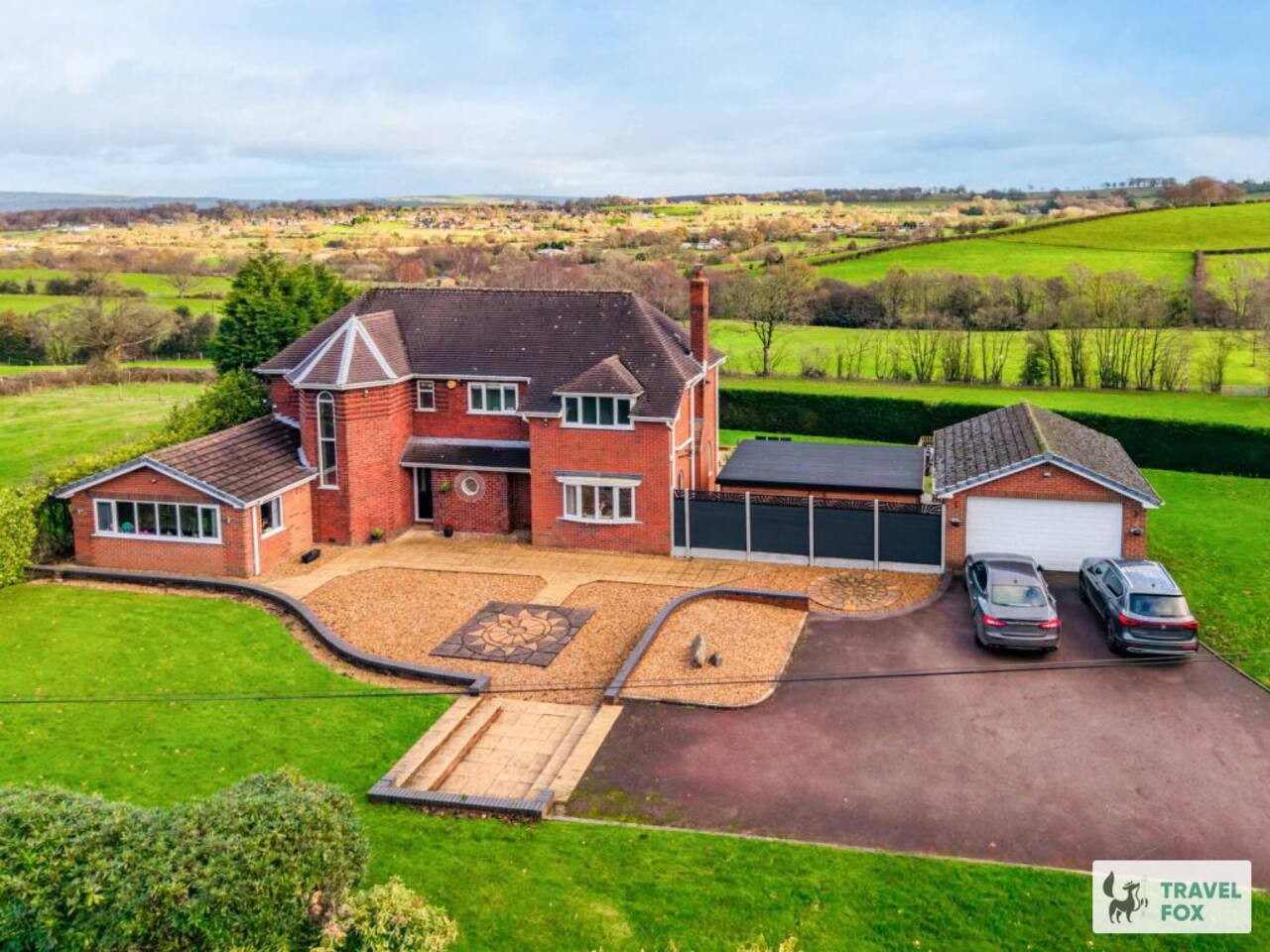
Cheddleton
Greenways House - Parking, Pool Table and Garden!
- Sleeps 10
- 4 bedrooms
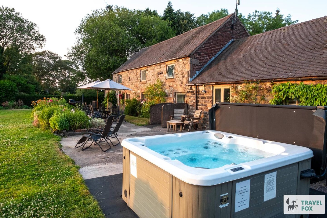
Cheddleton
Lee House Cottage + Annexe
- Sleeps 19
- 8 bedrooms

Leek
Silkwood House | Boutique 4 Bed nr. Peak District
- Sleeps 8
- 4 bedrooms
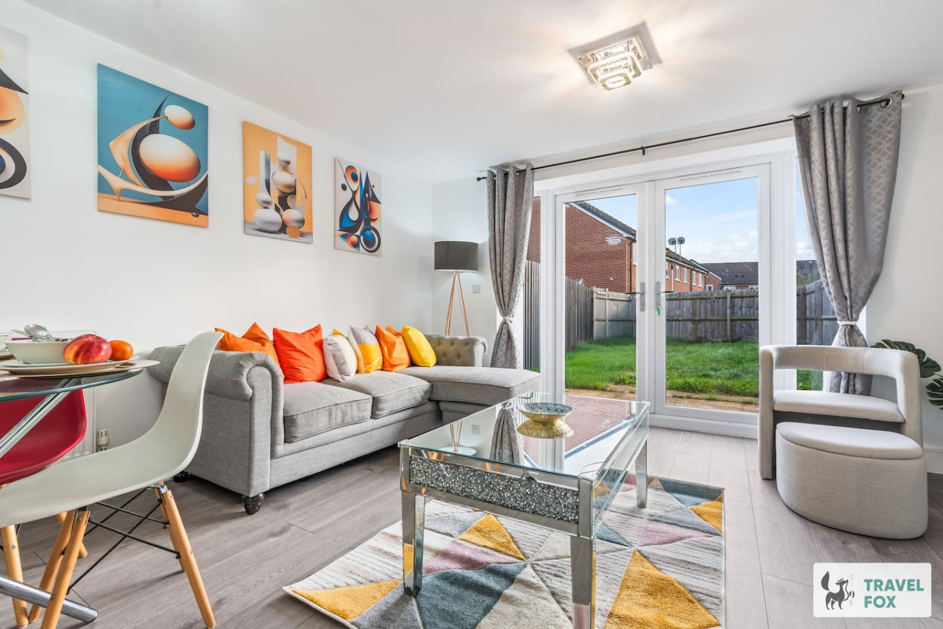
Stoke-on-Trent
Heather's House
- Sleeps 6
- 2 bedrooms
For homeowners
Own a holiday home near Great Haywood?
We manage holiday lets across Staffordshire from 12% commission, charged after cleaning costs, with no lock-in. A co-founder visits before you decide.
Holiday let management in Staffordshire →
A guide with a point of view
Written from research. Edited for real journeys.
Use the Official site links for live practical details, then use this guide for context, ideas and room to explore.
Photography credits & licences
Third-party photographs are credited to their named creators and reused under the linked Creative Commons licence or public-domain dedication. Travel Fox stores an optimised local copy; the file-specific changes and any browser-applied display crop are disclosed below. Reused photographs link both to the Wikimedia Commons source record and to the declared source image; Travel Fox's own photographs carry no such record and are marked as ours. These image licences do not cover Travel Fox text, branding or page design.
- File:Essex Bridge.jpg — photograph by Greg Pearce / Gjp23 at en.wikipedia; Gjp23 at the English Wikipedia. Source record on Wikimedia Commons. Declared source image. Licence: CC BY-SA 3.0. File changes: Downloaded from Wikimedia Commons, resized to a maximum 1920px edge and encoded as an optimised JPEG. Display changes: Displayed with responsive CSS cropping.
- File:Stafford Wood Lodge, Shugborough Estate, Great Haywood - geograph.org.uk - 4434715.jpg — photograph by Jo and Steve Turner; Stafford Wood Lodge, Shugborough Estate, Great Haywood by Jo and Steve Turner. Source record on Wikimedia Commons. Declared source image. Licence: CC BY-SA 2.0. File changes: Downloaded from Wikimedia Commons, resized to a maximum 1920px edge and encoded as an optimised JPEG. Display changes: Displayed with responsive CSS cropping.
- File:Canal at Great Haywood Junction in Staffordshire - geograph.org.uk - 6703303.jpg — photograph by Roger D Kidd; Canal at Great Haywood Junction in Staffordshire by Roger D Kidd. Source record on Wikimedia Commons. Declared source image. Licence: CC BY-SA 2.0. File changes: Downloaded from Wikimedia Commons, resized to a maximum 1920px edge and encoded as an optimised JPEG. Display changes: Displayed with responsive CSS cropping.