
Village beneath the Downs
South Harting
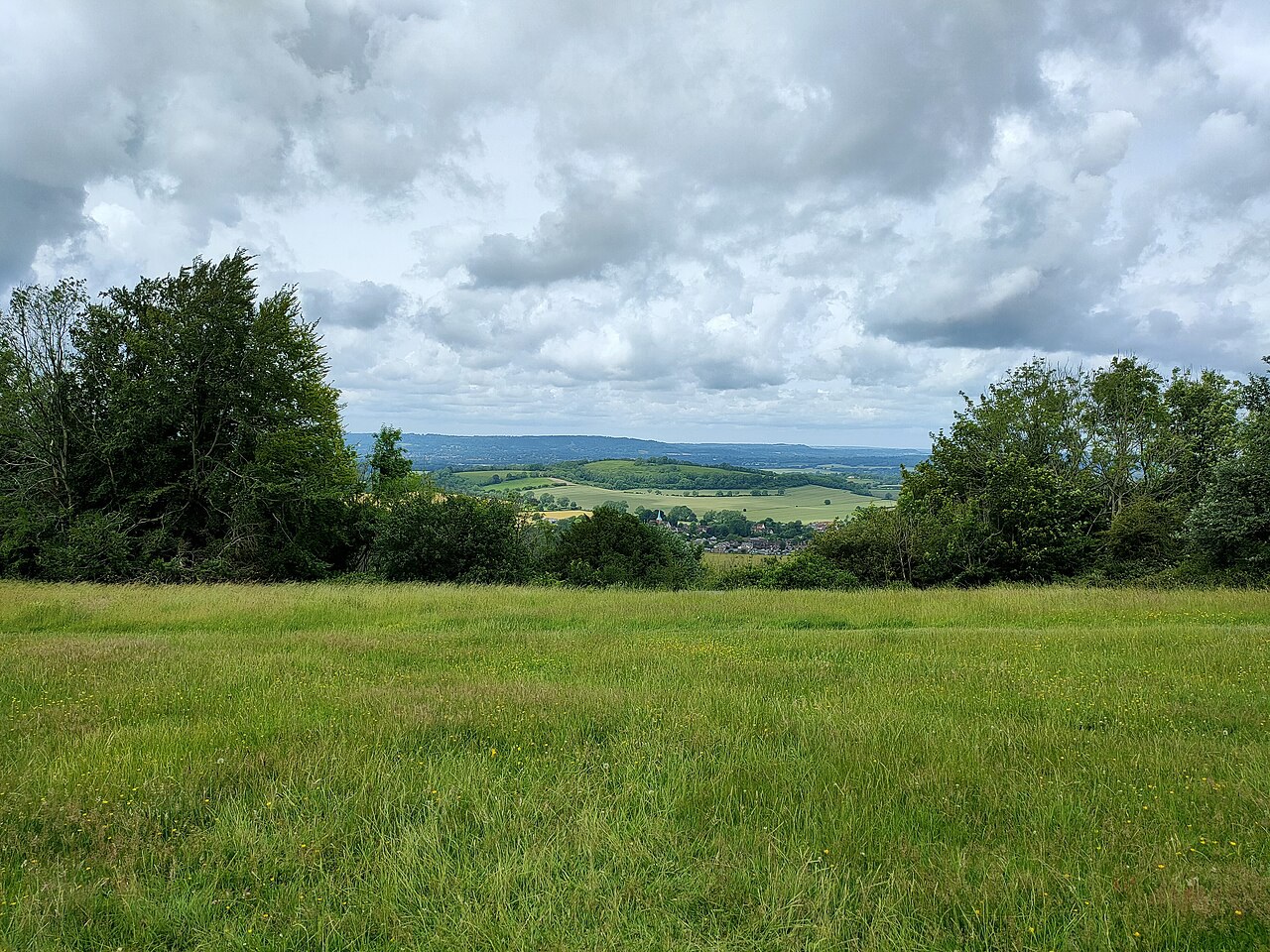
Ancient chalk grassland rises above a farming village of cottages, a copper-green church spire and direct access to the South Downs Way.
- Best for
- Chalk-downland walks and village history
- Give it
- Two hours to a full walking day
- Don't miss
- Harting Down's views across the Weald
Photo: PAUL FARMER · CC BY-SA 2.0 · cropped
The Fox verdict
A walking village with the Downs at its door
South Harting brings together a Grade I church, a community-backed shop, a walker-friendly pub and immediate access to chalk downland.
Come for Harting Down's ancient grassland and wide views, then return to a village where the parish church, the White Hart and Harting Village Stores make useful, characterful stops. Nearby Uppark adds a late-17th-century house, gardens and meadow walks to a day in the Downs.
Where to go
Places in South Harting
Every place below is checked against a published source, listed with what it is and how long to give it.
Local signatures
3 placesThe White Hart
South Harting's sole current pub serves food all day, has guest bedrooms and welcomes walkers coming from the South Downs Way.
- Visit length
- Editorial estimate: around 75 minutes
- Locality
- on The Street
- Access
- Dogs are supported in designated bedrooms, and outdoor dining is offered.
Harting Village Stores and Post Office
A village shop and Post Office selling locally sourced everyday food, daily in-store sandwiches and weekend croissants.
- Visit length
- Editorial estimate: around 20 minutes
- Locality
- on North Lane
South Harting Circular Walk
A moderate loop through fields to Nyewood and back by quiet lanes, passing views of the disused Petersfield–Midhurst railway and wooded Torberry Hill fort.
- Visit length
- Editorial estimate: around 2 hours 30 minutes
- Locality
- starting at the White Hart
- Access
- The published route is a moderate field-and-lane walk.
Walks & outdoors
1 place
Harting Down
A moderate four-mile circuit across ancient chalk downland, with Weald views and archaeology including an Iron Age hillfort, cross-ridge dykes and a Napoleonic telegraph-station site.
- Visit length
- Editorial estimate: around 2 hours 30 minutes
- Locality
- immediately above the village
- Access
- The four-mile circuit includes steep, uneven and unsurfaced sections.
History & heritage
2 places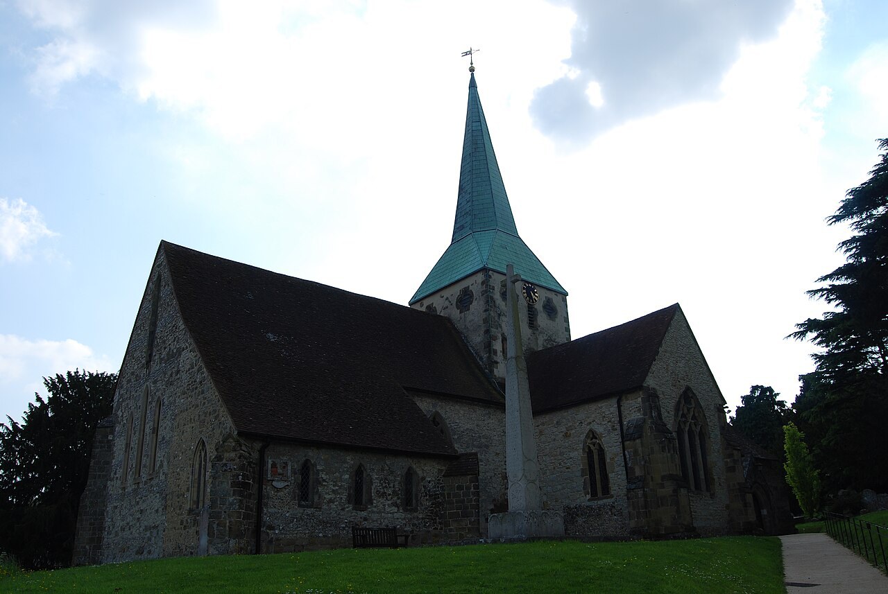
Parish Church of St Mary and St Gabriel
A largely circa-1300 cruciform church of malmstone rubble, with a central tower, copper-covered broached spire and a Grade II* war memorial in the churchyard.
- Visit length
- Editorial estimate: around 35 minutes
- Locality
- below Harting Down
- Access
- Historic England lists the church as the Parish Church of St Mary; the parish uses St Mary and St Gabriel.
Uppark House and Garden
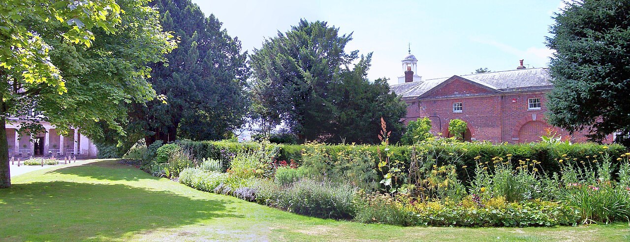
A late-17th-century house on the crown of the Downs, with intimate gardens, meadow walks, coastward views and links to H. G. Wells.
- Visit length
- Editorial estimate: around 2 hours 30 minutes
- Locality
- south of the village on the B2146
- Access
- Check the Official site for current visitor access before travel.
Things to do
1 placeWar Memorial Playing Fields
The village's Second World War memorial grounds include a sports pavilion, cricket and football pitches and tennis courts.
- Visit length
- Editorial estimate: around 60 minutes
- Locality
- on Petersfield Road
No places match this filter. Choose All places to reset the list.
Three ways to explore South Harting
Signature outings
Walk Harting Down
Follow the four-mile circuit across ancient chalk grassland for views over the Weald and traces of Beacon Hill's hillfort and telegraph station.
See the Copper-Green Spire
Visit the Grade I parish church for its largely circa-1300 fabric, broached copper-covered spire and separately listed churchyard memorial.
Explore Uppark
Pair the village with Uppark's late-17th-century house, intimate gardens, meadow walks and H. G. Wells connections.
The village story
South Harting Village Guide
A village of downland paths, a copper-green spire and traditions held at the foot of the South Downs.
Spire, Church and Memorial
The spire of the parish church is copper-green, broached, and visible from Harting Down, rising out of a cluster of cottages at the foot of the hill. The church beneath it is cruciform, built of malmstone rubble, and largely the work of about 1300. A fire around 1576 took the original roof, which was rebuilt before the century was out, and a north porch was added as recently as 1938. Historic England lists it as Grade I under the name St Mary, though the parish calls it St Mary and St Gabriel. The Cryll family added a south mortuary chapel around 1610. It was a ruin by the nineteenth century.
In the churchyard stands a thin stone cross designed in 1920 by Eric Gill, working with Desmond Chute, and with Hilary Stratton cutting the backgrounds of its reliefs. Those reliefs show the patron saints of England, Ireland, Scotland and Wales. It is the war memorial, and it is listed in its own right.
The White Hart and a Sussex Tribute
South Harting has one pub now, the White Hart, on The Street. A century ago the writer E. V. Lucas counted three — the Ship, the White Hart and the Coach and Horses — so the survivor carries the trade alone. It serves food all day, keeps guest bedrooms, and is used to walkers coming off the South Downs Way, with dogs. There are dog-friendly rooms, a canine menu, and treats from Sir Woofchester's, and you can eat outside. There is a summer menu, and the fish specials change daily.
Lucas liked the place. "We come to what is perhaps the most satisfying village in all Sussex—South Harting," he wrote. "Cool and spacious and retired, it lies under the Downs."
Village Stores and Downland Walks
For everything else there is Harting Village Stores and Post Office on North Lane, owned by Tim and Louise Waller and kept going by the village itself through the Harting Stores Association. Lord Caldecote, Peter Tuke and Colin Waller were among those who worked to preserve it, and early debenture holders raised and ultimately gave more than £22,000. It sells locally sourced bread, milk, fruit and vegetables, cheese, meat and pastries, makes sandwiches in-store each day, and puts out croissants at weekends. The Post Office counter handles postal and banking business.
The reason to come, though, is up the hill. Harting Down begins immediately above the village and gives straight onto the South Downs Way. A four-mile circuit crosses ancient chalk grassland — juniper, scrub, secluded valleys — with views north over the Weald to the North Downs and south to the Isle of Wight. Beacon Hill holds the remains of a Napoleonic telegraph station and an Iron Age hillfort with cross-ridge dykes. A longer loop of six or seven miles runs from the White Hart through fields to Nyewood, passing the old Petersfield-to-Midhurst railway, which opened in 1864 and closed in 1955, and the wooded fort on Torberry Hill. Ten parish routes are mapped in all, from a gentle two miles to seven.
Uppark and Getting Here
About a mile and a half south on the B2146 is Uppark, a house of around 1690 on the crown of the Downs, with gardens, meadow walks and views towards the coast. H. G. Wells spent time there — his mother Sarah worked in the house — and it became Bladesover in his novel Tono-Bungay. Sir Harry Fetherstonhaugh married his dairymaid, Mary Ann Bullock, when she was twenty and he was seventy.
Petersfield, five miles off, is the market town and the nearest station. The B2146 and B2141 carry you out towards it and towards Chichester, and the 54 bus and the volunteer-run Harting Minibus cover the same ground for anyone without a car, though it's worth checking times before you set out.
Playing Fields and Old Club Traditions
The playing fields on Petersfield Road — cricket, football, tennis, a pavilion — were bought from Sir Thomas Sopwith in 1947 and given to the village as its Second World War memorial. On Whit Monday the members of the Harting Old Club, a friendly society going back to 1800, still walk from their clubhouse to the church for a sermon, and then sit down to the feast.
Stay around South Downs
Make a longer stay of it
Travel Fox holiday homes around South Downs, linked directly to their property pages.
For homeowners
Own a holiday home near South Harting?
We manage holiday lets across the UK from 12% commission, charged after cleaning costs, with no lock-in. A co-founder visits before you decide.
How our holiday let management works →
A guide with a point of view
Written from research. Edited for real journeys.
Use the Official site links for live practical details, then use this guide for context, ideas and room to explore.
Photography credits & licences
Third-party photographs are credited to their named creators and reused under the linked Creative Commons licence or public-domain dedication. Travel Fox stores an optimised local copy; the file-specific changes and any browser-applied display crop are disclosed below. Reused photographs link both to the Wikimedia Commons source record and to the declared source image; Travel Fox's own photographs carry no such record and are marked as ours. These image licences do not cover Travel Fox text, branding or page design.
- File:Harting Down - geograph.org.uk - 7268824.jpg — photograph by PAUL FARMER; Harting Down by PAUL FARMER. Source record on Wikimedia Commons. Declared source image. Licence: CC BY-SA 2.0. File changes: Downloaded from Wikimedia Commons, resized to a maximum 1920px edge and encoded as an optimised JPEG. Display changes: Displayed with responsive CSS cropping.
- File:Parish Church of St Mary and St Gabriel (1) - geograph.org.uk - 2962655.jpg — photograph by Barry Shimmon; Parish Church of St Mary and St Gabriel (1) by Barry Shimmon. Source record on Wikimedia Commons. Declared source image. Licence: CC BY-SA 2.0. File changes: Downloaded from Wikimedia Commons, resized to a maximum 1920px edge and encoded as an optimised JPEG. Display changes: Displayed with responsive CSS cropping.
- File:Uppark House, Scented Garden - geograph.org.uk - 3612596.jpg — photograph by Len Williams; Uppark House, Scented Garden by Len Williams. Source record on Wikimedia Commons. Declared source image. Licence: CC BY-SA 2.0. File changes: Downloaded from Wikimedia Commons, resized to a maximum 1920px edge and encoded as an optimised JPEG. Display changes: Displayed with responsive CSS cropping.
Sources
Every place on this page is checked against a published source. Each entry links the record we used and names who publishes it.
- The White Hart — the-whitehart.co.uk operator, sector body or destination organisation
- Harting Village Stores and Post Office — harting-pc.gov.uk statutory register or public authority
- Parish Church of St Mary and St Gabriel — historicengland.org.uk statutory register or public authority record not machine-readable; publisher restricts automated access
- Harting Down — nationaltrust.org.uk national body or asset manager
- South Harting Circular Walk — southdowns.gov.uk statutory register or public authority
- War Memorial Playing Fields — harting-pc.gov.uk statutory register or public authority
- Uppark House and Garden — nationaltrust.org.uk national body or asset manager